Piedecuesta night lights from space
Night Light of Piedecuesta (Santander) from space (Colombia) Src. Average luminocity for 10x10km area is 34.0649% and for 50x50km: 12.1374%.
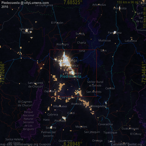
Analysis of Piedecuesta night lights 2016
Square area 10x10 km:
 5.19%
5.19%90-99
7.79%80-89
1.08%70-79
4.55%60-69
3.25%50-59
11.04%40-49
0.87%30-39
0%20-29
10.82%10-19
30.3%0-9
25.11%Square area 50x50 km:
1.96%90-99
1.86%80-89
0.48%70-79
3.05%60-69
1.89%50-59
1.34%40-49
0.36%30-39
1.5%20-29
2.81%10-19
7.97%0-9
76.77%Clear (daylight) street map image can be seen on geolist.org.
Map coordinates:
7° 41' 6.9" North, 73° 45' 9.6" West
6° 59' 16.4" North, 73° 2' 58.3" West
6° 17' 22.1" North, 72° 20' 47.1" West
Some cities around Piedecuesta sort by population:
• Bucaramanga
17.1 km =10.6 mi,  333°
333°
• Floridablanca
9.2 km =5.7 mi, 333°
• Girón
16 km =9.9 mi,  303°
303°
• San Gil
48.6 km =30.2 mi,  191°
191°
• Málaga
47.5 km =29.5 mi,  132°
132°
• San Vicente de Chucurí
41.5 km =25.8 mi,  253°
253°
• Lebrija
23.2 km =14.4 mi,  306°
306°
• Zapatoca
30.8 km =19.1 mi,  231°
231°
3672328 (p: 86,387)
Sources (retrieved 2019-11-25):
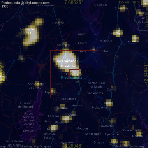
» NASA, Earths city lights 1995
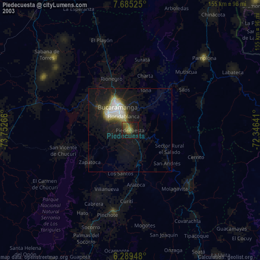
» NASA city lights 2003
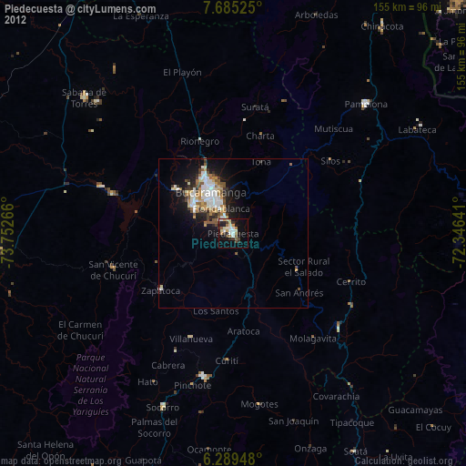
» Earth at Night: Flat Maps 2012, 2016