Frontino night lights from space
Night Light of Frontino (Antioquia) from space (Colombia) Src. Average luminocity for 10x10km area is 0.1602% and for 50x50km: 0.235%.
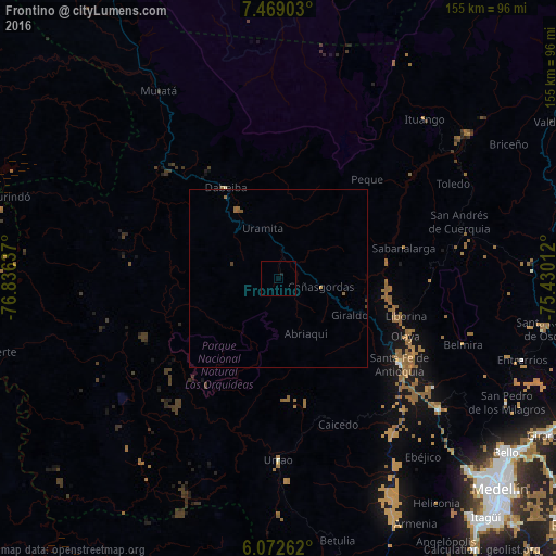
Analysis of Frontino night lights 2016
Square area 10x10 km:
 0%
0%90-99
0%80-89
0%70-79
0%60-69
0%50-59
0%40-49
0%30-39
0%20-29
0%10-19
0.87%0-9
99.13%Square area 50x50 km:
0%90-99
0%80-89
0%70-79
0.03%60-69
0.11%50-59
0.11%40-49
0.05%30-39
0.03%20-29
0%10-19
0.04%0-9
99.61%Clear (daylight) street map image can be seen on geolist.org.
Map coordinates:
7° 28' 8.5" North, 76° 50' 10.9" West
6° 46' 16.8" North, 76° 7' 59.7" West
6° 4' 21.4" North, 75° 25' 48.4" West
Some cities around Frontino sort by population:
• Urrao
50.5 km =31.4 mi,  180°
180°
• Santa Fe de Antioquia
41.3 km =25.7 mi,  125°
125°
• Dabeiba
29.5 km =18.3 mi,  329°
329°
• Ituango
60.3 km =37.5 mi,  42°
42°
• Santa Rosa de Osos
75.6 km =47 mi,  100°
100°
• San Pedro
72.3 km =44.9 mi,  118°
118°
• Cañasgordas
12.1 km =7.5 mi, 101°
• Betulia
75.1 km =46.7 mi,  167°
167°
3682313 (p: 8,603)
Sources (retrieved 2019-11-25):
» Earth at Night: Flat Maps 2012, 2016