El Cerrito night lights from space
Night Light of El Cerrito (Valle del Cauca) from space (Colombia) Src. Average luminocity for 10x10km area is 14.4502% and for 50x50km: 16.7018%.
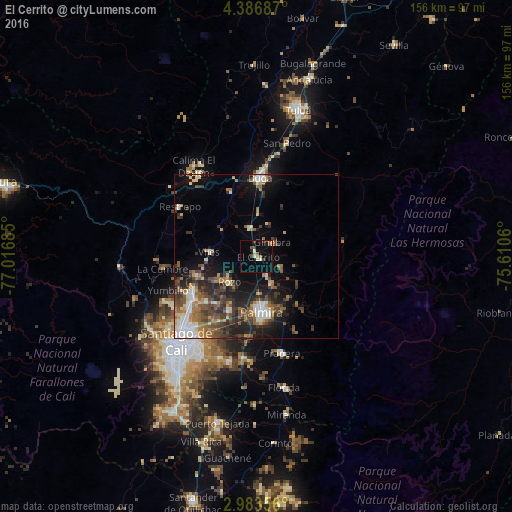
Analysis of El Cerrito night lights 2016
Square area 10x10 km:
 0.43%
0.43%90-99
1.52%80-89
2.81%70-79
0.43%60-69
1.73%50-59
3.46%40-49
1.73%30-39
2.38%20-29
1.73%10-19
3.46%0-9
80.3%Square area 50x50 km:
2.14%90-99
2.2%80-89
1.61%70-79
1.48%60-69
2.85%50-59
3.12%40-49
3.95%30-39
3.52%20-29
4.61%10-19
7.89%0-9
66.64%Clear (daylight) street map image can be seen on geolist.org.
Map coordinates:
4° 23' 12.7" North, 77° 1' 0.7" West
3° 41' 7.8" North, 76° 18' 49.4" West
2° 59' 0.8" North, 75° 36' 38.2" West
Some cities around El Cerrito sort by population:
• Palmira
16.3 km =10.1 mi,  176°
176°
• Guadalajara de Buga
24 km =14.9 mi,  4°
4°
• Yumbo
22.8 km =14.2 mi,  239°
239°
• Pradera
30.4 km =18.9 mi,  165°
165°
• Guacarí
9 km =5.6 mi,  346°
346°
• Restrepo
27.7 km =17.2 mi,  303°
303°
• Yotoco
20.9 km =13 mi,  338°
338°
• Ginebra
6.8 km =4.2 mi,  50°
50°
3684615 (p: 38,390)
Sources (retrieved 2019-11-25):
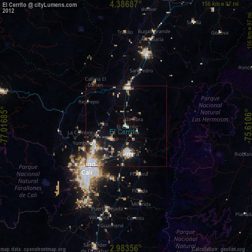
» Earth at Night: Flat Maps 2012, 2016