Córdoba night lights from space
Night Light of Córdoba (Bolívar) from space (Colombia) Src. Average luminocity for 10x10km area is 0.355% and for 50x50km: 0.5519%.
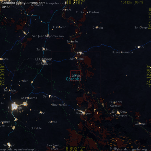
Analysis of Córdoba night lights 2016
Square area 10x10 km:
 0%
0%90-99
0%80-89
0%70-79
0%60-69
0%50-59
0%40-49
0.87%30-39
0%20-29
0%10-19
0%0-9
99.13%Square area 50x50 km:
0.06%90-99
0.11%80-89
0.03%70-79
0.03%60-69
0.08%50-59
0.1%40-49
0.2%30-39
0.08%20-29
0%10-19
0.05%0-9
99.24%Clear (daylight) street map image can be seen on geolist.org.
Map coordinates:
10° 16' 43.3" North, 75° 31' 48.6" West
9° 35' 10" North, 74° 49' 37.4" West
8° 53' 31.6" North, 74° 7' 26.1" West
Some cities around Córdoba sort by population:
• Magangué
39.1 km =24.3 mi,  168°
168°
• Plato
23.2 km =14.4 mi,  12°
12°
• El Carmen de Bolívar
35.3 km =21.9 mi,  294°
294°
• Santa Ana
40.9 km =25.4 mi,  136°
136°
• San Pedro
33.6 km =20.9 mi,  230°
230°
• Zambrano
18 km =11.2 mi,  3°
3°
• Cicuco
39.8 km =24.7 mi,  149°
149°
• Talaigua Viejo
40.4 km =25.1 mi, 138°
3685893 (p: 6,597)
Sources (retrieved 2019-11-25):
» Earth at Night: Flat Maps 2012, 2016