Arjona night lights from space
Night Light of Arjona (Bolívar) from space (Colombia) Src. Average luminocity for 10x10km area is 12.1033% and for 50x50km: 11.4694%.
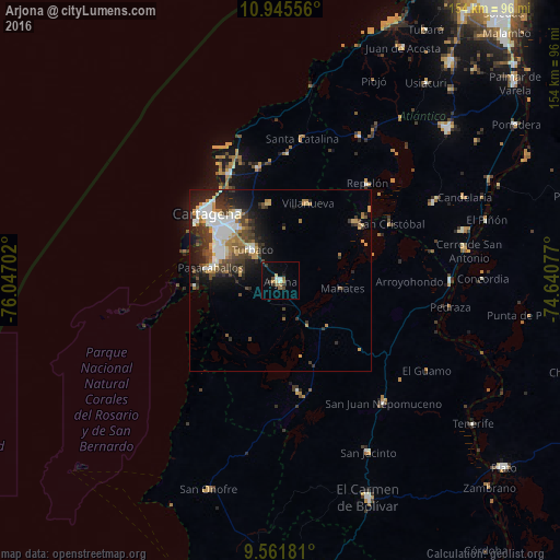
Analysis of Arjona night lights 2016
Square area 10x10 km:
 0.41%
0.41%90-99
2.07%80-89
0.83%70-79
1.24%60-69
2.27%50-59
2.27%40-49
2.07%30-39
2.07%20-29
1.45%10-19
3.51%0-9
81.82%Square area 50x50 km:
2.27%90-99
1.95%80-89
0.87%70-79
1.43%60-69
1.78%50-59
0.81%40-49
1.94%30-39
2.69%20-29
2.95%10-19
5.51%0-9
77.8%Clear (daylight) street map image can be seen on geolist.org.
Map coordinates:
10° 56' 44" North, 76° 2' 49.3" West
10° 15' 16" North, 75° 20' 38" West
9° 33' 42.5" North, 74° 38' 26.8" West
Some cities around Arjona sort by population:
• Cartagena
24.7 km =15.3 mi,  310°
310°
• Turbaco
11.1 km =6.9 mi,  318°
318°
• San Pablo
24.1 km =15 mi,  159°
159°
• Villanueva
22.4 km =13.9 mi,  20°
20°
• San Estanislao
26.5 km =16.5 mi,  52°
52°
• Santa Rosa
21.3 km =13.2 mi,  352°
352°
• Turbaná
10.9 km =6.8 mi,  280°
280°
• Mahates
17 km =10.6 mi,  98°
98°
3689570 (p: 50,405)
Sources (retrieved 2019-11-25):
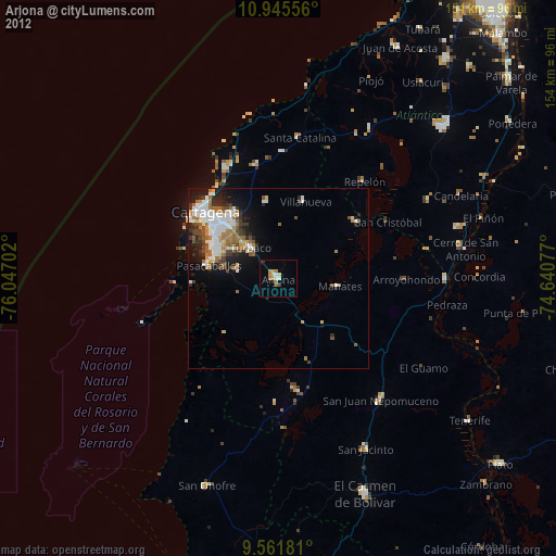
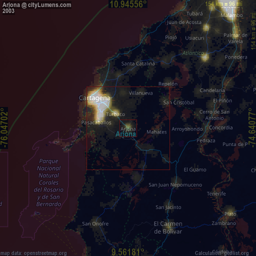
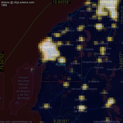
» NASA, Earths city lights 1995
» NASA city lights 2003
» Earth at Night: Flat Maps 2012, 2016