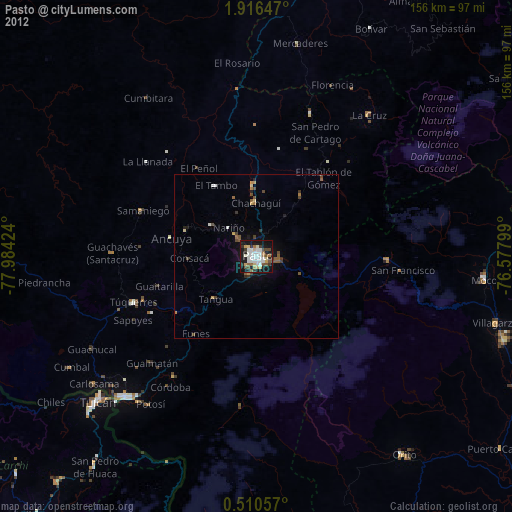
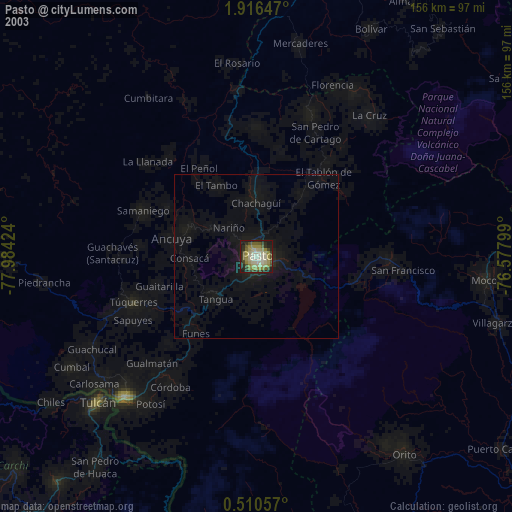
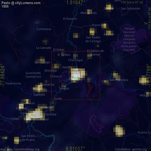
Pasto night lights from space
Night Light of Pasto (Nariño) from space (Colombia) Src. Average luminocity for 10x10km area is 64.0606% and for 50x50km: 5.6204%.
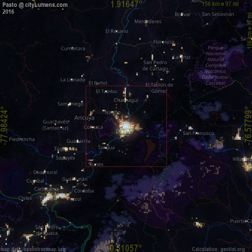
Analysis of Pasto night lights 2016
Square area 10x10 km:
 13.64%
90-99
14.07%80-89
8.44%70-79
8.23%60-69
13.2%50-59
6.93%40-49
11.9%30-39
4.98%20-29
14.94%10-19
3.68%0-9
0%Square area 50x50 km:
0.55%90-99
0.87%80-89
0.54%70-79
0.67%60-69
0.95%50-59
0.71%40-49
0.93%30-39
1.37%20-29
1.36%10-19
3.7%0-9
88.36%Clear (daylight) street map image can be seen on geolist.org.
Map coordinates:
1° 54' 59.3" North, 77° 59' 3.3" West
1° 12' 49" North, 77° 16' 52" West
0° 30' 38.1" North, 76° 34' 40.8" West
Some cities around Pasto sort by population:
• Túquerres
40.1 km =24.9 mi,  249°
249°
• Samaniego
37.6 km =23.4 mi,  291°
291°
• Sandoná
22.4 km =13.9 mi, 291°
• Olaya Herrera
23.6 km =14.7 mi,  279°
279°
• Sibundoy
39.9 km =24.8 mi,  91°
91°
• El Tambo
24.9 km =15.5 mi,  330°
330°
• Guaitarilla
31.1 km =19.3 mi, 252°
• Ancuya
26.4 km =16.4 mi, 282°
3672778 (p: 382,236)
Sources (retrieved 2019-11-25):
» NASA, Earths city lights 1995
» NASA city lights 2003
» Earth at Night: Flat Maps 2012, 2016