Abejorral night lights from space
Night Light of Abejorral (Antioquia) from space (Colombia) Src. Average luminocity for 10x10km area is 1.5517% and for 50x50km: 1.8134%.
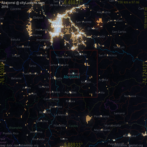
Analysis of Abejorral night lights 2016
Square area 10x10 km:
 0.41%
0.41%90-99
0.41%80-89
0%70-79
0%60-69
0%50-59
0%40-49
0.62%30-39
1.03%20-29
0%10-19
0%0-9
97.52%Square area 50x50 km:
0.09%90-99
0.26%80-89
0.07%70-79
0.46%60-69
0.69%50-59
0.16%40-49
0.05%30-39
0.11%20-29
0.15%10-19
0.65%0-9
97.31%Clear (daylight) street map image can be seen on geolist.org.
Map coordinates:
6° 29' 18.1" North, 76° 7' 49.4" West
5° 47' 21.4" North, 75° 25' 38.1" West
5° 5' 21.6" North, 74° 43' 26.9" West
Some cities around Abejorral sort by population:
• La Ceja
26.9 km =16.7 mi,  358°
358°
• Aguadas
20 km =12.4 mi,  189°
189°
• Sonsón
15.6 km =9.7 mi,  124°
124°
• Santa Bárbara
18.1 km =11.2 mi,  301°
301°
• Fredonia
30.9 km =19.2 mi, 299°
• La Unión
21.8 km =13.5 mi,  19°
19°
• Pácora
29.4 km =18.3 mi, 186°
• La Pintada
20.3 km =12.6 mi,  257°
257°
3690592 (p: 7,360)
Sources (retrieved 2019-11-25):
» Earth at Night: Flat Maps 2012, 2016