Changping night lights from space
Night Light of Changping (Beijing) from space (China) Src. Average luminocity for 10x10km area is 71.5373% and for 50x50km: 34.6817%.
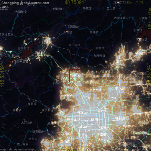
Analysis of Changping night lights 2016
Square area 10x10 km:
 11.85%
90-99
13.96%80-89
12.18%70-79
18.34%60-69
19.32%50-59
7.31%40-49
6.49%30-39
3.57%20-29
6.49%10-19
0.49%0-9
0%Square area 50x50 km:
7.17%90-99
6.18%80-89
6.14%70-79
7.1%60-69
6.38%50-59
4.71%40-49
2.81%30-39
2.63%20-29
3.42%10-19
6.32%0-9
47.15%Clear (daylight) street map image can be seen on geolist.org.
Map coordinates:
40° 45' 3.3" North, 115° 31' 53.7" East
40° 12' 58" North, 116° 14' 5" East
39° 40' 37.5" North, 116° 56' 16.2" East
Some cities around Changping sort by population:
• Beijing
37 km =23 mi,  158°
158°
• Langfang
87.8 km =54.6 mi,  153°
153°
• Mentougou
33.2 km =20.6 mi,  201°
201°
• Tongzhou
50.3 km =31.3 mi,  133°
133°
• Shunyi
36.6 km =22.7 mi,  106°
106°
• Daxing
53.5 km =33.2 mi,  171°
171°
• Fangshan
62.2 km =38.6 mi, 199°
• Liangxiang
54.1 km =33.6 mi,  189°
189°
2038154 (p: 93,174)
Sources (retrieved 2019-11-25):
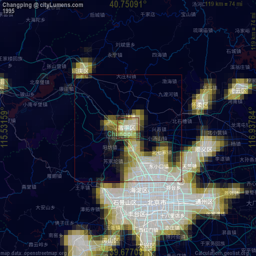
» NASA, Earths city lights 1995
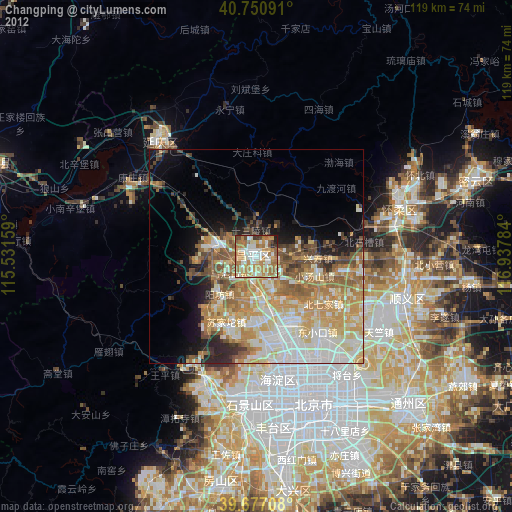
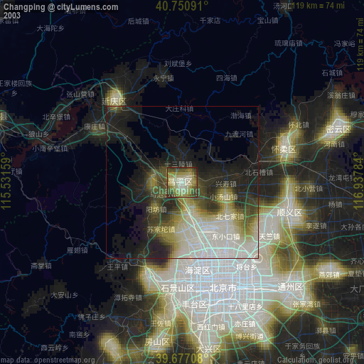
» NASA city lights 2003
» Earth at Night: Flat Maps 2012, 2016