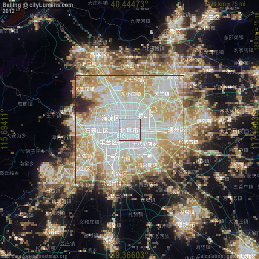
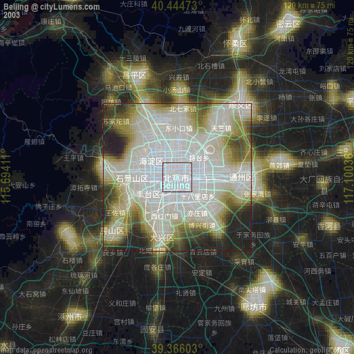
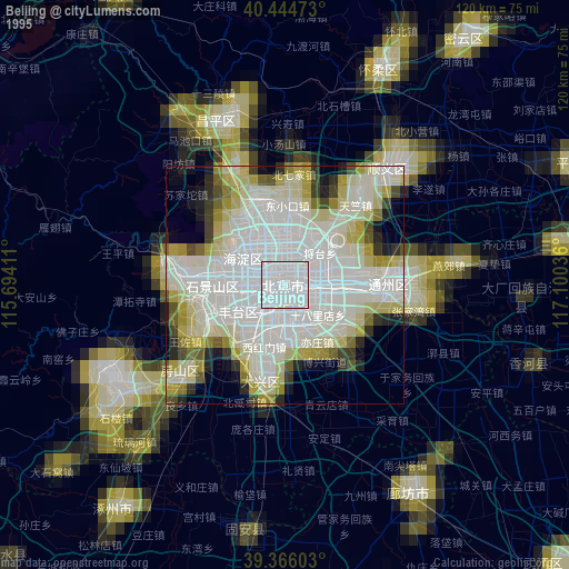
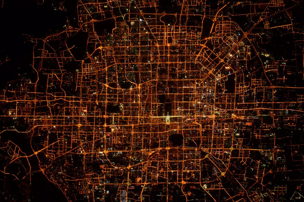
Beijing night lights from space
Night Light of Beijing from space (China) Src. Average luminocity for 10x10km area is 100% and for 50x50km: 86.1612%.
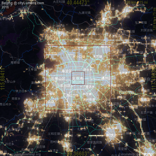
Analysis of Beijing night lights 2016
Square area 10x10 km:
 100%
100%90-99
0%80-89
0%70-79
0%60-69
0%50-59
0%40-49
0%30-39
0%20-29
0%10-19
0%0-9
0%Square area 50x50 km:
37.16%90-99
20.27%80-89
12.3%70-79
12.7%60-69
7.8%50-59
4.47%40-49
2.5%30-39
1.58%20-29
1.22%10-19
0%0-9
0%Clear (daylight) street map image can be seen on geolist.org.
Map coordinates:
40° 26' 41" North, 115° 41' 38.8" East
39° 54' 27" North, 116° 23' 50" East
39° 21' 57.7" North, 117° 6' 1.3" East
Fantastic image of Beijing from space taken by astronauts [src2], but I don't have information about it's orientation, scale or angle. If necessary, it was rotated manually, so North points approximately to upper direction. Click to zoom in:
Some cities around Beijing sort by population:
• Langfang
51 km =31.7 mi,  150°
150°
• Mentougou
26.2 km =16.3 mi,  277°
277°
• Tongzhou
22.6 km =14 mi,  91°
91°
• Shunyi
32 km =19.9 mi,  41°
41°
• Daxing
19.5 km =12.1 mi,  197°
197°
• Fangshan
42.1 km =26.2 mi,  234°
234°
• Changping
37 km =23 mi,  338°
338°
• Liangxiang
29.5 km =18.3 mi, 229°
1816670 (p: 11,716,620)
Sources (retrieved 2019-11-25):
» NASA, Earths city lights 1995
» NASA city lights 2003
» Earth at Night: Flat Maps 2012, 2016
Src.2: Tim Kopra, Twitter/@astro_tim, 2016-03-20