Linfen night lights from space
Night Light of Linfen (Shanxi) from space (China) Src. Average luminocity for 10x10km area is 77.2601% and for 50x50km: 9.8038%.
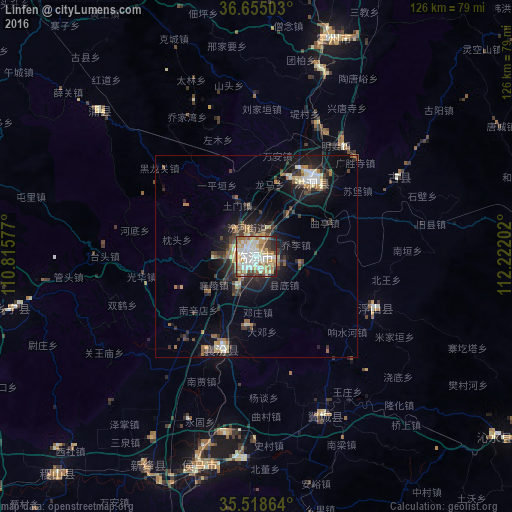
Analysis of Linfen night lights 2016
Square area 10x10 km:
 18.86%
90-99
24.18%80-89
11.9%70-79
12.82%60-69
11.17%50-59
4.4%40-49
6.78%30-39
4.58%20-29
4.58%10-19
0.73%0-9
0%Square area 50x50 km:
1.1%90-99
1.53%80-89
1.24%70-79
1.03%60-69
1.43%50-59
1.06%40-49
1.24%30-39
2.76%20-29
2.38%10-19
7.02%0-9
79.21%Clear (daylight) street map image can be seen on geolist.org.
Map coordinates:
36° 39' 18.1" North, 110° 48' 56.8" East
36° 5' 20" North, 111° 31' 8" East
35° 31' 7.1" North, 112° 13' 19.3" East
Some cities around Linfen sort by population:
• Changzhi
99.8 km =62 mi,  168°
168°
• Jincheng
135.3 km =84.1 mi,  118°
118°
• Yuncheng
127.7 km =79.3 mi,  201°
201°
• Yima
153.8 km =95.6 mi, 167°
• Jiexiu
109.8 km =68.2 mi,  18°
18°
• Xinzhi
48.5 km =30.1 mi, 20°
• Hancheng
120.6 km =74.9 mi,  234°
234°
• Gutao
137.1 km =85.2 mi,  25°
25°
1803567 (p: 232,566)
Sources (retrieved 2019-11-25):
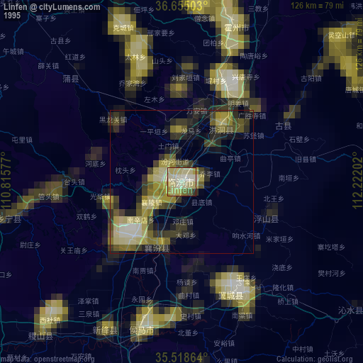
» NASA, Earths city lights 1995
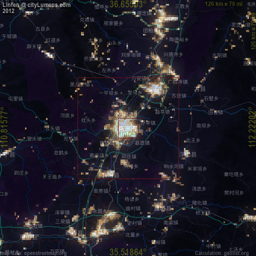
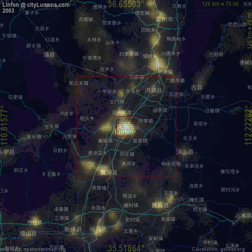
» NASA city lights 2003
» Earth at Night: Flat Maps 2012, 2016