Yancheng night lights from space
Night Light of Yancheng (Jiangsu) from space (China) Src. Average luminocity for 10x10km area is 97.2692% and for 50x50km: 17.5744%.
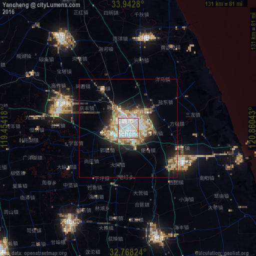
Analysis of Yancheng night lights 2016
Square area 10x10 km:
 57.87%
90-99
32.52%80-89
6.29%70-79
2.97%60-69
0.35%50-59
0%40-49
0%30-39
0%20-29
0%10-19
0%0-9
0%Square area 50x50 km:
3.63%90-99
2.81%80-89
2.98%70-79
1.94%60-69
2.52%50-59
2.25%40-49
2%30-39
2.04%20-29
3.93%10-19
7.44%0-9
68.44%Clear (daylight) street map image can be seen on geolist.org.
Map coordinates:
33° 56' 34.1" North, 119° 27' 15" East
33° 21' 27" North, 120° 9' 26.3" East
32° 46' 5.7" North, 120° 51' 37.5" East
Some cities around Yancheng sort by population:
• Dongtai
57.9 km =36 mi,  165°
165°
• Xinghua
55.4 km =34.4 mi,  212°
212°
• Gaoyou
91.8 km =57 mi,  226°
226°
• Hede
47.1 km =29.3 mi,  11°
11°
• Dazhong
33 km =20.5 mi,  122°
122°
• Baoying
80.1 km =49.8 mi,  259°
259°
• Dongkan
77.5 km =48.2 mi,  337°
337°
• Qinnan
25.5 km =15.8 mi,  242°
242°
1787746 (p: 628,441)
Sources (retrieved 2019-11-25):
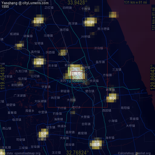
» NASA, Earths city lights 1995
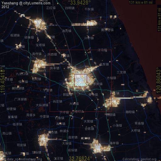
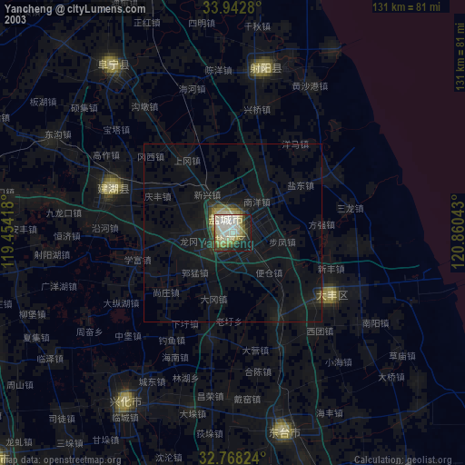
» NASA city lights 2003
» Earth at Night: Flat Maps 2012, 2016