Dazhong night lights from space
Night Light of Dazhong (Jiangsu) from space (China) Src. Average luminocity for 10x10km area is 58.2238% and for 50x50km: 10.5177%.
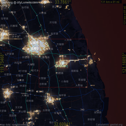
Analysis of Dazhong night lights 2016
Square area 10x10 km:
 5.77%
5.77%90-99
6.99%80-89
16.08%70-79
9.79%60-69
11.54%50-59
11.71%40-49
9.09%30-39
6.47%20-29
13.46%10-19
9.09%0-9
0%Square area 50x50 km:
1.18%90-99
1.32%80-89
2.33%70-79
1.52%60-69
1.62%50-59
1.57%40-49
1.25%30-39
1.23%20-29
2.14%10-19
5.73%0-9
80.14%Clear (daylight) street map image can be seen on geolist.org.
Map coordinates:
33° 47' 10" North, 119° 45' 16.8" East
33° 11' 59" North, 120° 27' 28.1" East
32° 36' 33.9" North, 121° 9' 39.3" East
Some cities around Dazhong sort by population:
• Yancheng
33 km =20.5 mi,  302°
302°
• Taizhou
94.1 km =58.5 mi,  213°
213°
• Dongtai
41 km =25.5 mi,  199°
199°
• Xinghua
64.9 km =40.3 mi,  243°
243°
• Gaoyou
105.2 km =65.4 mi, 244°
• Hede
66.2 km =41.1 mi,  344°
344°
• Jiangyan
82.5 km =51.3 mi, 200°
• Qinnan
51 km =31.7 mi,  276°
276°
1813088 (p: 84,323)
Sources (retrieved 2019-11-25):
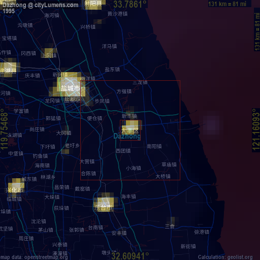
» NASA, Earths city lights 1995
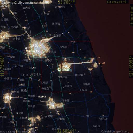
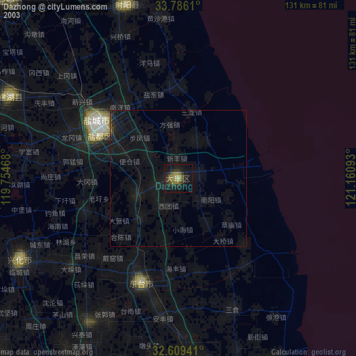
» NASA city lights 2003
» Earth at Night: Flat Maps 2012, 2016