Wulingyuan night lights from space
Night Light of Wulingyuan (Hunan) from space (China) Src. Average luminocity for 10x10km area is 1.2216% and for 50x50km: 1.0954%.
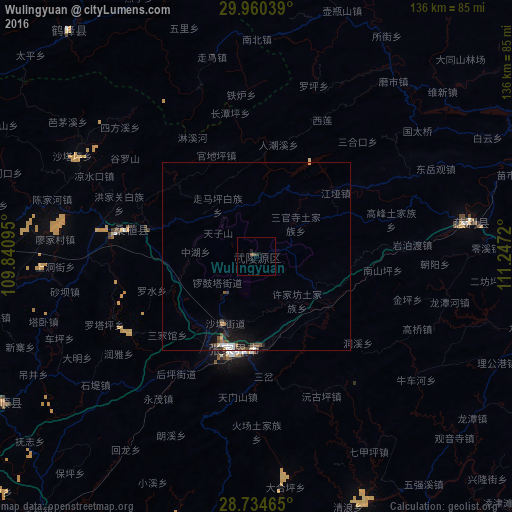
Analysis of Wulingyuan night lights 2016
Square area 10x10 km:
 0%
0%90-99
0%80-89
0%70-79
0%60-69
0%50-59
0.76%40-49
0.76%30-39
0.76%20-29
0.38%10-19
0.38%0-9
96.97%Square area 50x50 km:
0.13%90-99
0.13%80-89
0.09%70-79
0.03%60-69
0.14%50-59
0.17%40-49
0.35%30-39
0.23%20-29
0.1%10-19
1.05%0-9
97.57%Clear (daylight) street map image can be seen on geolist.org.
Map coordinates:
29° 57' 37.4" North, 109° 50' 27.4" East
29° 20' 57.7" North, 110° 32' 38.7" East
28° 44' 4.7" North, 111° 14' 49.9" East
Some cities around Wulingyuan sort by population:
• Changde
115.1 km =71.5 mi,  107°
107°
• Zhicheng
140.2 km =87.1 mi,  41°
41°
• Qianzhou
139.1 km =86.4 mi,  214°
214°
• Enshi
147.1 km =91.4 mi,  315°
315°
• Zhangjiajie
25.3 km =15.7 mi,  194°
194°
• Jinshi
131.5 km =81.7 mi,  77°
77°
• Zhijiang
166.7 km =103.6 mi, 44°
• Anxiang
155.7 km =96.7 mi,  87°
87°
1785805 (p: 52,712)
Sources (retrieved 2019-11-25):
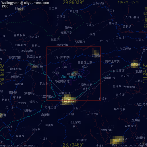
» NASA, Earths city lights 1995
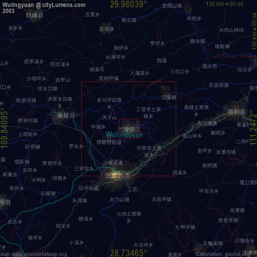
» NASA city lights 2003
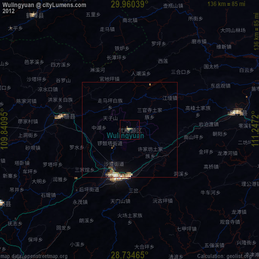
» Earth at Night: Flat Maps 2012, 2016