Tangzhai night lights from space
Night Light of Tangzhai (Anhui) from space (China) Src. Average luminocity for 10x10km area is 0% and for 50x50km: 2.0952%.
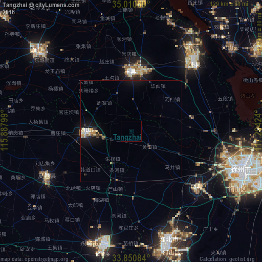


Analysis of Tangzhai night lights 2016
Square area 10x10 km:
 0%
0%90-99
0%80-89
0%70-79
0%60-69
0%50-59
0%40-49
0%30-39
0%20-29
0%10-19
0%0-9
100%Square area 50x50 km:
0.11%90-99
0.4%80-89
0.31%70-79
0.28%60-69
0.17%50-59
0.21%40-49
0.18%30-39
0.36%20-29
0.32%10-19
2.5%0-9
95.15%Clear (daylight) street map image can be seen on geolist.org.
Map coordinates:
35° 0' 38.5" North, 115° 53' 16.8" East
34° 25' 58" North, 116° 35' 28" East
33° 51' 3" North, 117° 17' 39.3" East
Some cities around Tangzhai sort by population:
• Tongshan
59.1 km =36.7 mi,  118°
118°
• Huaibei
54.2 km =33.7 mi,  160°
160°
• Xiazhen
62.9 km =39.1 mi,  49°
49°
• Shancheng
61.6 km =38.3 mi,  310°
310°
• Suixi
62.6 km =38.9 mi, 164°
• Yucheng
56.3 km =35 mi,  348°
348°
• Taozhuang
82.2 km =51.1 mi,  55°
55°
• Fengxian
30.1 km =18.7 mi,  359°
359°
1793286 (p: 67,936)
Sources (retrieved 2019-11-25):
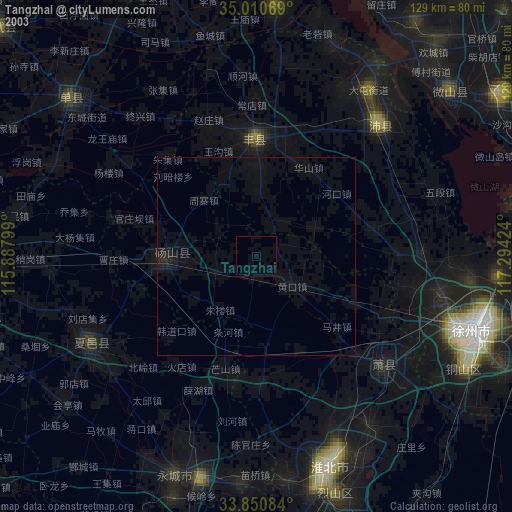
» NASA, Earths city lights 1995
» NASA city lights 2003
» Earth at Night: Flat Maps 2012, 2016