Tongshan night lights from space
Night Light of Tongshan (Jiangsu) from space (China) Src. Average luminocity for 10x10km area is 61.8498% and for 50x50km: 24.4706%.
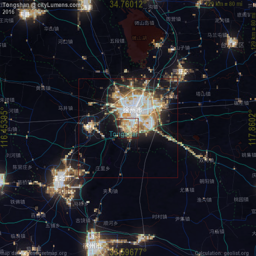
Analysis of Tongshan night lights 2016
Square area 10x10 km:
 7.69%
7.69%90-99
13%80-89
12.27%70-79
10.99%60-69
17.03%50-59
6.04%40-49
3.66%30-39
8.79%20-29
12.27%10-19
7.51%0-9
0.73%Square area 50x50 km:
4.55%90-99
4.95%80-89
3.29%70-79
3.47%60-69
3.23%50-59
2.93%40-49
2.76%30-39
3.48%20-29
5.4%10-19
10.16%0-9
55.79%Clear (daylight) street map image can be seen on geolist.org.
Map coordinates:
34° 45' 36.4" North, 116° 27' 14.2" East
34° 10' 49.6" North, 117° 9' 25.5" East
33° 35' 48.4" North, 117° 51' 36.7" East
Some cities around Tongshan sort by population:
• Huaibei
40.7 km =25.3 mi,  235°
235°
• Suzhou
62.7 km =39 mi,  195°
195°
• Xiazhen
69.3 km =43.1 mi,  356°
356°
• Pizhou
74.3 km =46.2 mi,  78°
78°
• Suixi
47.7 km =29.6 mi,  227°
227°
• Tangzhai
59.1 km =36.7 mi,  298°
298°
• Suicheng
78.2 km =48.6 mi,  113°
113°
• Taozhuang
76.2 km =47.3 mi,  12°
12°
1787824 (p: 1,199,193)
Sources (retrieved 2019-11-25):
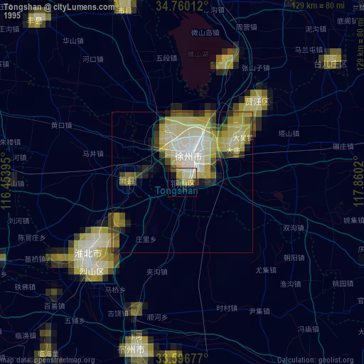
» NASA, Earths city lights 1995
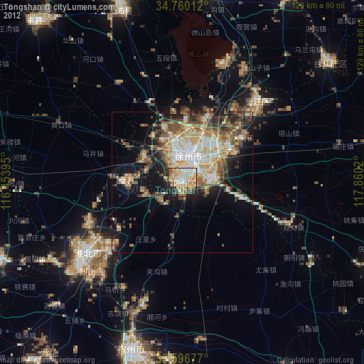
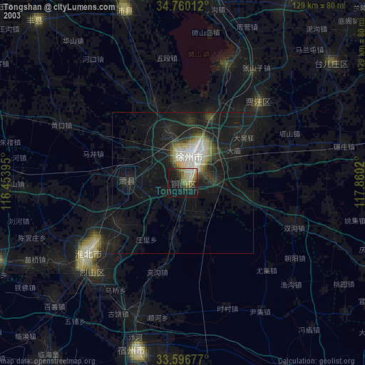
» NASA city lights 2003
» Earth at Night: Flat Maps 2012, 2016