Shihezi night lights from space
Night Light of Shihezi (Xinjiang) from space (China) Src. Average luminocity for 10x10km area is 35.9485% and for 50x50km: 4.686%.
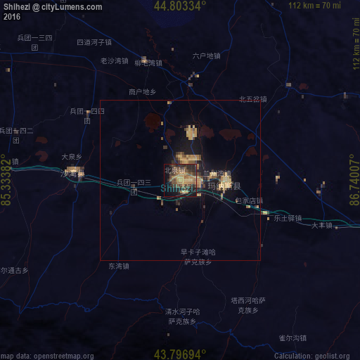
Analysis of Shihezi night lights 2016
Square area 10x10 km:
 0%
0%90-99
0%80-89
6.21%70-79
6.52%60-69
10%50-59
6.97%40-49
11.36%30-39
9.85%20-29
15.45%10-19
18.48%0-9
15.15%Square area 50x50 km:
0%90-99
0%80-89
0.99%70-79
1.08%60-69
0.83%50-59
0.79%40-49
0.98%30-39
0.8%20-29
1.16%10-19
4.36%0-9
89%Clear (daylight) street map image can be seen on geolist.org.
Map coordinates:
44° 48' 12" North, 85° 20' 1.8" East
44° 18' 8.3" North, 86° 2' 13" East
43° 47' 49" North, 86° 44' 24.3" East
Some cities around Shihezi sort by population:
• Ürümqi
136.8 km =85 mi,  114°
114°
• Xinyuan
243.7 km =151.4 mi,  246°
246°
• Karamay
168.9 km =104.9 mi,  327°
327°
• Changji
106.3 km =66.1 mi, 107°
• Baijiantan
170 km =105.6 mi,  335°
335°
• Hoxtolgay
246.5 km =153.2 mi,  359°
359°
• Sishilichengzi
262.7 km =163.2 mi,  172°
172°
• Baluntaicun
183.1 km =113.8 mi, 172°
1529195 (p: 572,772)
Sources (retrieved 2019-11-25):
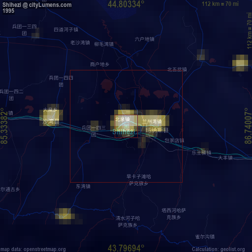
» NASA, Earths city lights 1995
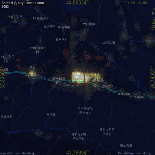
» NASA city lights 2003
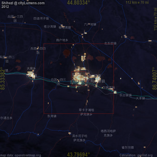
» Earth at Night: Flat Maps 2012, 2016