Ürümqi night lights from space
Night Light of Ürümqi (Xinjiang) from space (China) Src. Average luminocity for 10x10km area is 91.0697% and for 50x50km: 27.0541%.
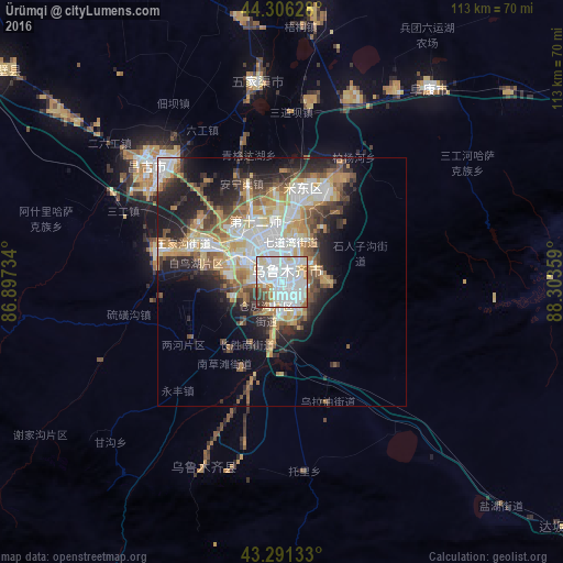
Analysis of Ürümqi night lights 2016
Square area 10x10 km:
 53.03%
90-99
22.58%80-89
6.21%70-79
6.36%60-69
3.33%50-59
3.03%40-49
2.42%30-39
2.73%20-29
0.3%10-19
0%0-9
0%Square area 50x50 km:
6.19%90-99
5.09%80-89
3.43%70-79
3.85%60-69
3.81%50-59
3.09%40-49
3.31%30-39
3.41%20-29
6.15%10-19
8.88%0-9
52.79%Clear (daylight) street map image can be seen on geolist.org.
Map coordinates:
44° 18' 22.6" North, 86° 53' 50.4" East
43° 48' 3.5" North, 87° 36' 1.7" East
43° 17' 28.8" North, 88° 18' 12.9" East
Some cities around Ürümqi sort by population:
• Shihezi
136.8 km =85 mi,  294°
294°
• Karamay
292.1 km =181.5 mi,  312°
312°
• Turpan
159 km =98.8 mi,  126°
126°
• Changji
33 km =20.5 mi, 314°
• Korla
255.8 km =158.9 mi,  207°
207°
• Baijiantan
286.4 km =178 mi,  317°
317°
• Sishilichengzi
224 km =139.2 mi,  204°
204°
• Baluntaicun
162.9 km =101.2 mi,  219°
219°
1529102 (p: 3,029,372)
Sources (retrieved 2019-11-25):
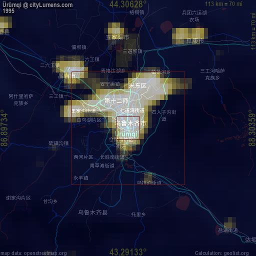
» NASA, Earths city lights 1995
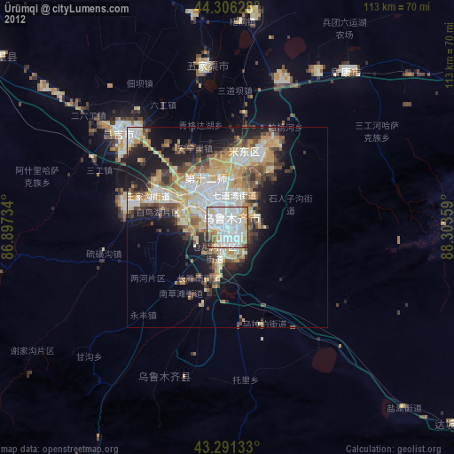
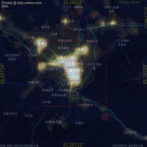
» NASA city lights 2003
» Earth at Night: Flat Maps 2012, 2016