Qionghai night lights from space
Night Light of Qionghai (Hainan) from space (China) Src. Average luminocity for 10x10km area is 44.4827% and for 50x50km: 4.1112%.
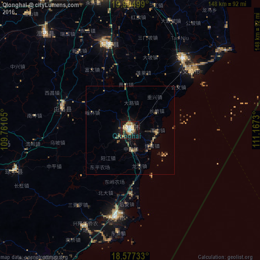
Analysis of Qionghai night lights 2016
Square area 10x10 km:
 4.76%
4.76%90-99
3.9%80-89
16.88%70-79
4.55%60-69
8.44%50-59
3.03%40-49
4.33%30-39
5.84%20-29
7.58%10-19
37.66%0-9
3.03%Square area 50x50 km:
0.18%90-99
0.14%80-89
1.13%70-79
0.35%60-69
0.58%50-59
0.6%40-49
0.71%30-39
0.7%20-29
1%10-19
3.15%0-9
91.48%Clear (daylight) street map image can be seen on geolist.org.
Map coordinates:
19° 54' 18" North, 109° 45' 39.8" East
19° 14' 33" North, 110° 27' 51" East
18° 34' 38.4" North, 111° 10' 2.3" East
Some cities around Qionghai sort by population:
• Haikou
90.2 km =56 mi,  351°
351°
• Xiuying
86.2 km =53.6 mi, 348°
• Sanya
150.2 km =93.3 mi,  222°
222°
• Wenchang
51.1 km =31.8 mi,  35°
35°
• Xucheng
124.8 km =77.5 mi, 345°
• Jinjiang
72.1 km =44.8 mi,  318°
318°
• Wanning
50 km =31.1 mi,  189°
189°
• Lincheng
110.1 km =68.4 mi,  312°
312°
1806488 (p: 480,000)
Sources (retrieved 2019-11-25):
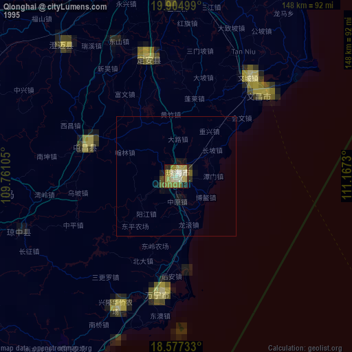
» NASA, Earths city lights 1995
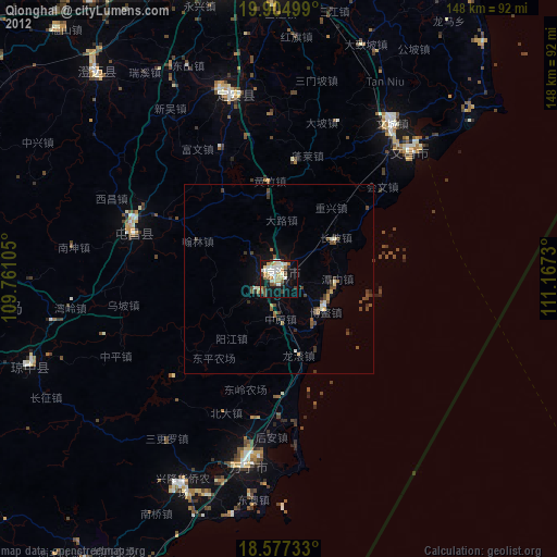
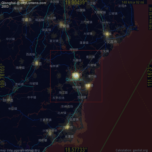
» NASA city lights 2003
» Earth at Night: Flat Maps 2012, 2016