Xiuying night lights from space
Night Light of Xiuying (Hainan) from space (China) Src. Average luminocity for 10x10km area is 94.6647% and for 50x50km: 26.94%.
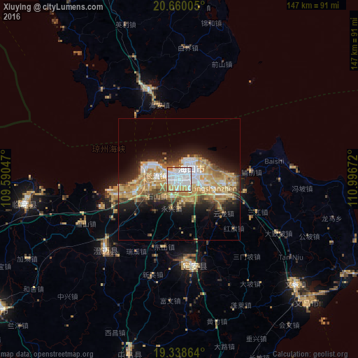
Analysis of Xiuying night lights 2016
Square area 10x10 km:
 50.6%
50.6%90-99
29.56%80-89
5.56%70-79
10.52%60-69
3.77%50-59
0%40-49
0%30-39
0%20-29
0%10-19
0%0-9
0%Square area 50x50 km:
4.82%90-99
3.87%80-89
5.23%70-79
5.17%60-69
5.36%50-59
2.22%40-49
3.27%30-39
2.49%20-29
5.35%10-19
8.59%0-9
53.64%Clear (daylight) street map image can be seen on geolist.org.
Map coordinates:
20° 39' 36.2" North, 109° 35' 25.7" East
20° 0' 2.6" North, 110° 17' 36.9" East
19° 20' 19.1" North, 110° 59' 48.2" East
Some cities around Xiuying sort by population:
• Haikou
7.1 km =4.4 mi,  45°
45°
• Qionghai
86.2 km =53.6 mi,  168°
168°
• Wenchang
64 km =39.8 mi,  131°
131°
• Qiongshan
6.4 km =4 mi,  84°
84°
• Xucheng
38.8 km =24.1 mi,  340°
340°
• Jinjiang
42.5 km =26.4 mi,  224°
224°
• Wanning
133.9 km =83.2 mi,  175°
175°
• Lincheng
64.4 km =40 mi,  260°
260°
1788245 (p: 290,000)
Sources (retrieved 2019-11-25):
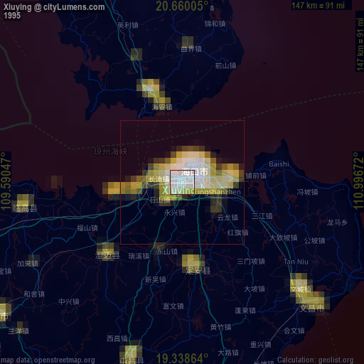
» NASA, Earths city lights 1995
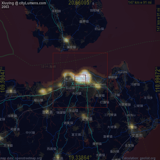
» NASA city lights 2003
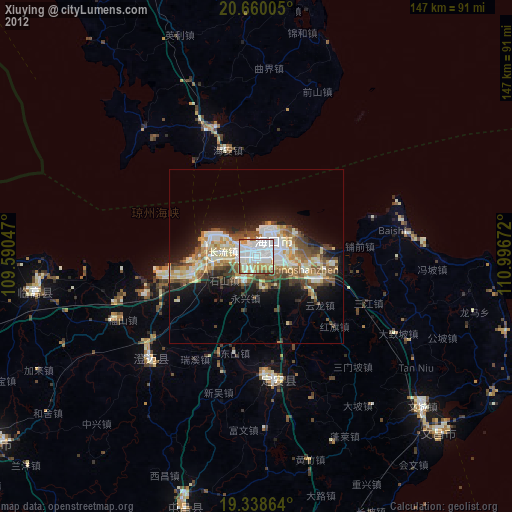
» Earth at Night: Flat Maps 2012, 2016