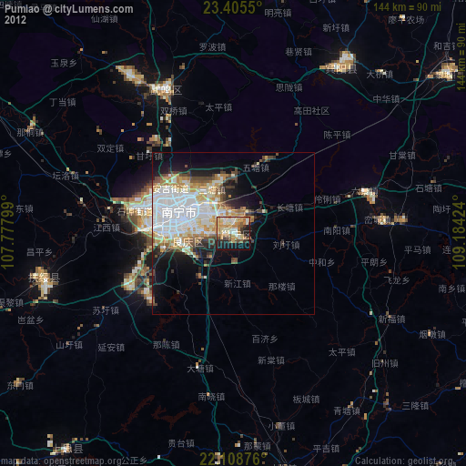
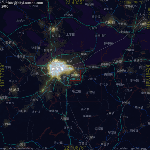
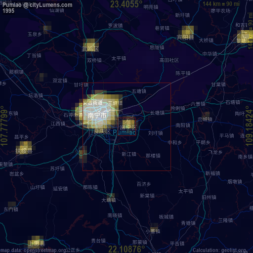
Pumiao night lights from space
Night Light of Pumiao (Guangxi) from space (China) Src. Average luminocity for 10x10km area is 63.4286% and for 50x50km: 24.6163%.
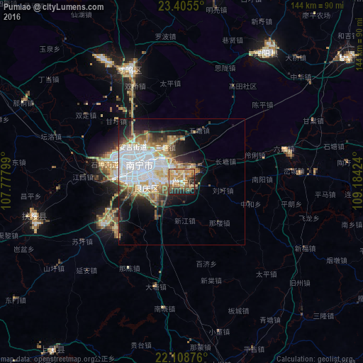
Analysis of Pumiao night lights 2016
Square area 10x10 km:
 9.13%
9.13%90-99
7.14%80-89
12.1%70-79
19.64%60-69
13.49%50-59
7.94%40-49
9.13%30-39
5.75%20-29
9.72%10-19
5.75%0-9
0.2%Square area 50x50 km:
8.5%90-99
3.94%80-89
3.01%70-79
3.29%60-69
2.64%50-59
2.35%40-49
2.24%30-39
2.55%20-29
3.56%10-19
7.21%0-9
60.71%Clear (daylight) street map image can be seen on geolist.org.
Map coordinates:
23° 24' 19.8" North, 107° 46' 40.8" East
22° 45' 31.2" North, 108° 28' 52" East
22° 6' 31.5" North, 109° 11' 3.3" East
Some cities around Pumiao sort by population:
• Nanning
18 km =11.2 mi,  290°
290°
• Beihai
155.5 km =96.6 mi,  155°
155°
• Qinzhou
88.6 km =55.1 mi,  170°
170°
• Guigang
121.5 km =75.5 mi,  71°
71°
• Móng Cái, VN
147.1 km =91.4 mi,  201°
201°
• Lianzhou
142.3 km =88.4 mi,  148°
148°
• Baihe
145.9 km =90.7 mi,  241°
241°
• Laibin
131.9 km =82 mi,  37°
37°
1798480 (p: 61,690)
Sources (retrieved 2019-11-25):
» NASA, Earths city lights 1995
» NASA city lights 2003
» Earth at Night: Flat Maps 2012, 2016