Qinzhou night lights from space
Night Light of Qinzhou (Guangxi) from space (China) Src. Average luminocity for 10x10km area is 71.0992% and for 50x50km: 7.9421%.
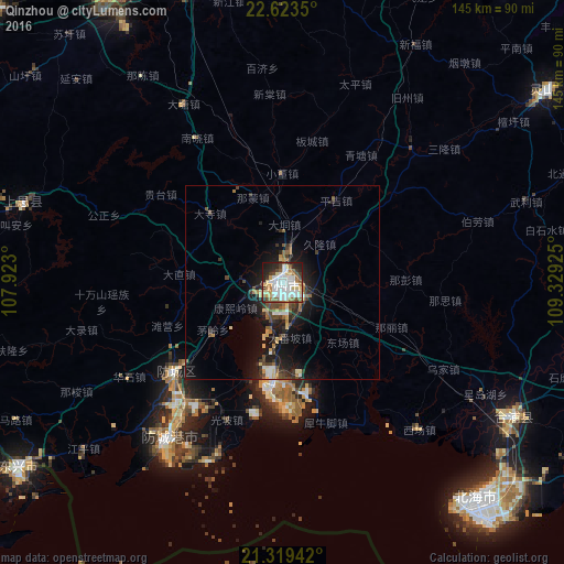
Analysis of Qinzhou night lights 2016
Square area 10x10 km:
 22.82%
90-99
20.63%80-89
9.52%70-79
4.17%60-69
6.35%50-59
7.94%40-49
6.35%30-39
4.37%20-29
13.29%10-19
4.56%0-9
0%Square area 50x50 km:
1.26%90-99
1.06%80-89
0.97%70-79
0.66%60-69
0.93%50-59
1.07%40-49
1.47%30-39
1.12%20-29
2.43%10-19
6.65%0-9
82.36%Clear (daylight) street map image can be seen on geolist.org.
Map coordinates:
22° 37' 24.6" North, 107° 55' 22.8" East
21° 58' 22.7" North, 108° 37' 34" East
21° 19' 9.9" North, 109° 19' 45.3" East
Some cities around Qinzhou sort by population:
• Nanning
99.1 km =61.6 mi,  341°
341°
• Beihai
73.2 km =45.5 mi,  138°
138°
• Guigang
160.6 km =99.8 mi,  38°
38°
• Móng Cái, VN
84.4 km =52.4 mi,  233°
233°
• Lianzhou
68.5 km =42.6 mi,  119°
119°
• Baihe
144.8 km =90 mi,  277°
277°
• Pumiao
88.6 km =55.1 mi,  350°
350°
• Yashan
137.8 km =85.6 mi,  79°
79°
1797551 (p: 100,996)
Sources (retrieved 2019-11-25):
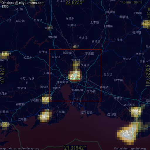
» NASA, Earths city lights 1995
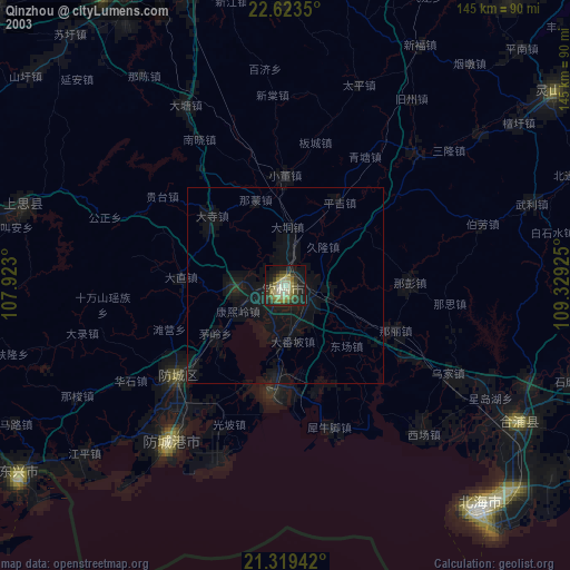
» NASA city lights 2003
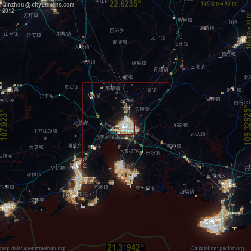
» Earth at Night: Flat Maps 2012, 2016