Huangyan night lights from space
Night Light of Huangyan (Zhejiang) from space (China) Src. Average luminocity for 10x10km area is 66.0265% and for 50x50km: 28.7323%.
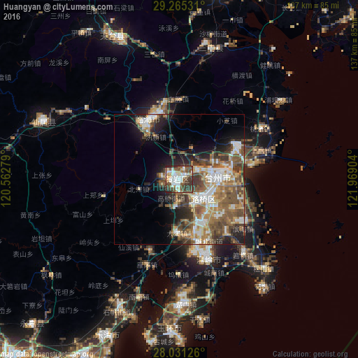
Analysis of Huangyan night lights 2016
Square area 10x10 km:
 16.67%
90-99
15.72%80-89
5.3%70-79
6.63%60-69
3.98%50-59
14.2%40-49
17.61%30-39
15.34%20-29
4.55%10-19
0%0-9
0%Square area 50x50 km:
4.64%90-99
5.08%80-89
2.64%70-79
3.21%60-69
5.2%50-59
6.44%40-49
6.29%30-39
5.48%20-29
5.47%10-19
7.56%0-9
47.99%Clear (daylight) street map image can be seen on geolist.org.
Map coordinates:
29° 15' 55.1" North, 120° 33' 46" East
28° 39' 0.4" North, 121° 15' 57.3" East
28° 1' 52.5" North, 121° 58' 8.5" East
Some cities around Huangyan sort by population:
• Wenzhou
93.1 km =57.8 mi,  219°
219°
• Jiaojiang
20.9 km =13 mi,  75°
75°
• Luqiao
13.2 km =8.2 mi,  126°
126°
• Linhai
25.7 km =16 mi,  332°
332°
• Fenghua
112.7 km =70 mi,  6°
6°
• Ninghai
72.7 km =45.2 mi, 12°
• Wenling
32.7 km =20.3 mi,  159°
159°
• Xianju
56.8 km =35.3 mi,  293°
293°
1807143 (p: 150,448)
Sources (retrieved 2019-11-25):
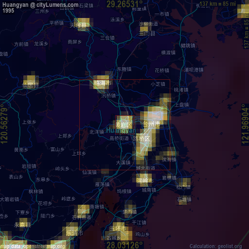
» NASA, Earths city lights 1995
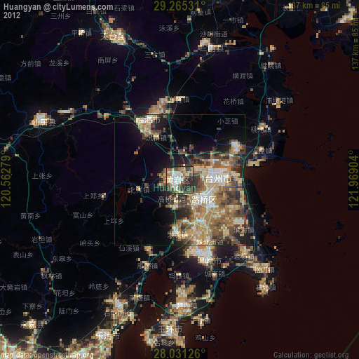
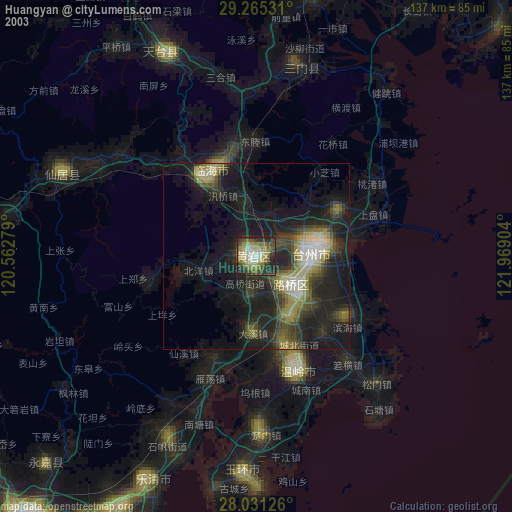
» NASA city lights 2003
» Earth at Night: Flat Maps 2012, 2016