Nanyang night lights from space
Night Light of Nanyang (Henan) from space (China) Src. Average luminocity for 10x10km area is 90.5733% and for 50x50km: 9.6845%.
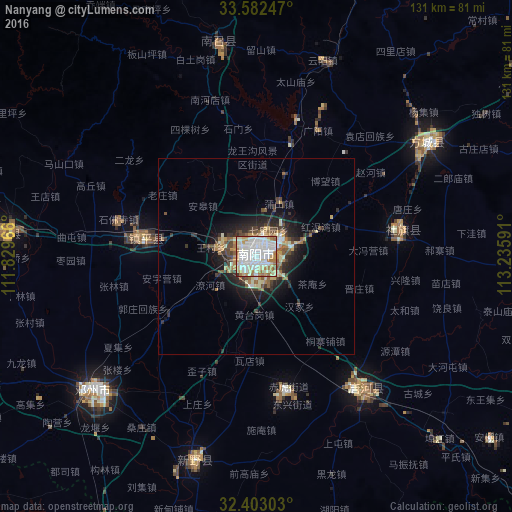
Analysis of Nanyang night lights 2016
Square area 10x10 km:
 37%
37%90-99
33.15%80-89
8.24%70-79
6.59%60-69
13.74%50-59
0.92%40-49
0%30-39
0.37%20-29
0%10-19
0%0-9
0%Square area 50x50 km:
1.64%90-99
1.95%80-89
1.04%70-79
1.05%60-69
1.49%50-59
1.2%40-49
1.12%30-39
1.71%20-29
2.62%10-19
4.89%0-9
81.29%Clear (daylight) street map image can be seen on geolist.org.
Map coordinates:
33° 34' 56.9" North, 111° 49' 46.8" East
32° 59' 41" North, 112° 31' 58" East
32° 24' 10.9" North, 113° 14' 9.3" East
Some cities around Nanyang sort by population:
• Pingdingshan
109.2 km =67.9 mi,  40°
40°
• Laohekou
105.5 km =65.6 mi,  230°
230°
• Zaoyang
98.7 km =61.3 mi,  167°
167°
• Danjiangkou
108.1 km =67.2 mi,  242°
242°
• Yunyang
53.1 km =33 mi,  18°
18°
• Binhe
43.8 km =27.2 mi,  141°
141°
• Hancheng
55.6 km =34.5 mi,  197°
197°
• Huazhou
54.6 km =33.9 mi, 230°
1799629 (p: 251,532)
Sources (retrieved 2019-11-25):
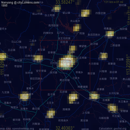
» NASA, Earths city lights 1995
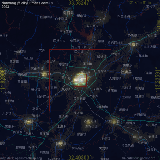
» NASA city lights 2003
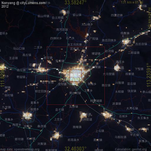
» Earth at Night: Flat Maps 2012, 2016