Jiehu night lights from space
Night Light of Jiehu (Shandong) from space (China) Src. Average luminocity for 10x10km area is 38.5989% and for 50x50km: 4.063%.
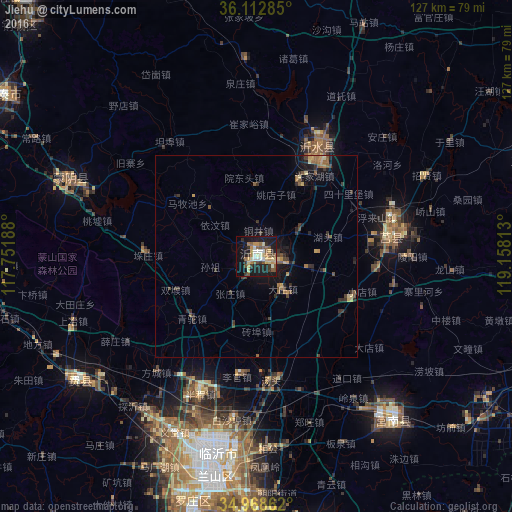
Analysis of Jiehu night lights 2016
Square area 10x10 km:
 3.66%
3.66%90-99
5.86%80-89
7.33%70-79
6.78%60-69
4.76%50-59
7.69%40-49
3.66%30-39
5.49%20-29
7.14%10-19
34.07%0-9
13.55%Square area 50x50 km:
0.14%90-99
0.22%80-89
0.63%70-79
0.58%60-69
0.59%50-59
0.89%40-49
0.65%30-39
1.02%20-29
1.02%10-19
3.59%0-9
90.67%Clear (daylight) street map image can be seen on geolist.org.
Map coordinates:
36° 6' 46.3" North, 117° 45' 6.8" East
35° 32' 34" North, 118° 27' 18" East
34° 58' 7" North, 119° 9' 29.3" East
Some cities around Jiehu sort by population:
• Linyi
54.3 km =33.7 mi,  190°
190°
• Yishui
31.1 km =19.3 mi,  30°
30°
• Shizilu
53.5 km =33.2 mi,  140°
140°
• Feicheng
54.2 km =33.7 mi,  234°
234°
• Pingyi
74.7 km =46.4 mi,  266°
266°
• Chengyang
34.4 km =21.4 mi,  83°
83°
• Mengyin
51.1 km =31.8 mi,  290°
290°
• Xiazhuang
71.7 km =44.6 mi,  166°
166°
1805884 (p: 69,245)
Sources (retrieved 2019-11-25):
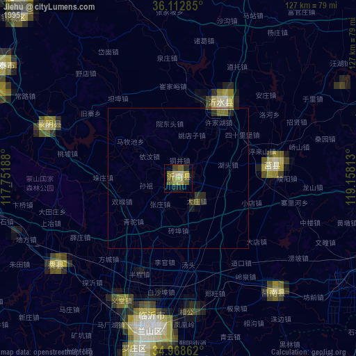
» NASA, Earths city lights 1995
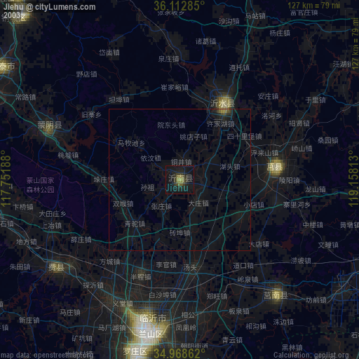
» NASA city lights 2003
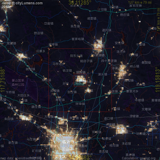
» Earth at Night: Flat Maps 2012, 2016