Chengyang night lights from space
Night Light of Chengyang (Shandong) from space (China) Src. Average luminocity for 10x10km area is 37.4441% and for 50x50km: 5.0257%.
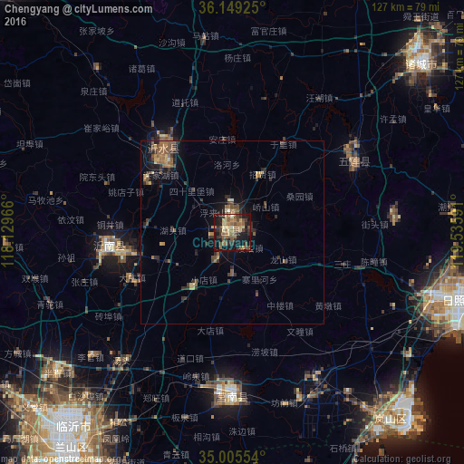
Analysis of Chengyang night lights 2016
Square area 10x10 km:
 0%
0%90-99
1.4%80-89
6.47%70-79
4.2%60-69
9.79%50-59
12.06%40-49
11.01%30-39
7.17%20-29
8.92%10-19
33.74%0-9
5.24%Square area 50x50 km:
0.04%90-99
0.1%80-89
0.62%70-79
0.48%60-69
1.23%50-59
1.53%40-49
1.05%30-39
1.25%20-29
1.47%10-19
3.67%0-9
88.57%Clear (daylight) street map image can be seen on geolist.org.
Map coordinates:
36° 8' 57.3" North, 118° 7' 46.8" East
35° 34' 46" North, 118° 49' 58" East
35° 0' 19.9" North, 119° 32' 9.3" East
Some cities around Chengyang sort by population:
• Zhu Cheng City
69.1 km =42.9 mi,  48°
48°
• Linyi
72.6 km =45.1 mi,  217°
217°
• Rizhao
58.8 km =36.5 mi,  106°
106°
• Mizhou
68.7 km =42.7 mi, 47°
• Yishui
29.4 km =18.3 mi,  320°
320°
• Shizilu
45.4 km =28.2 mi,  180°
180°
• Jiehu
34.4 km =21.4 mi,  263°
263°
• Xiazhuang
75.8 km =47.1 mi,  193°
193°
1815184 (p: 66,588)
Sources (retrieved 2019-11-25):
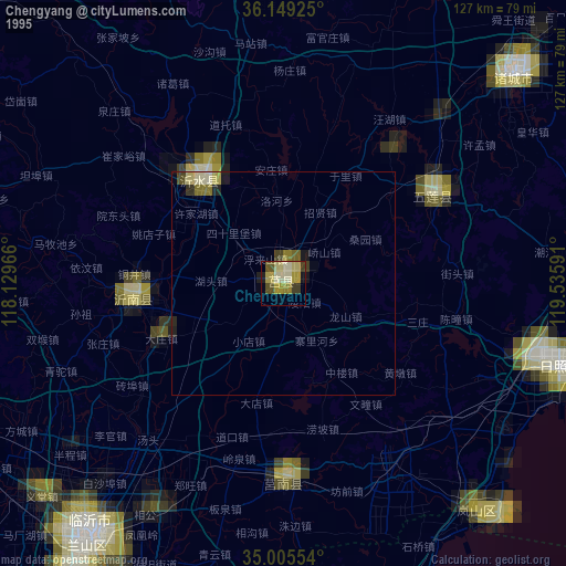
» NASA, Earths city lights 1995
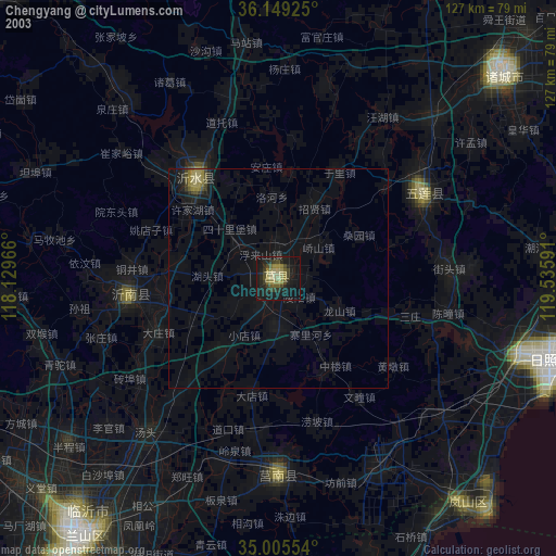
» NASA city lights 2003
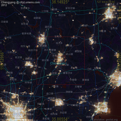
» Earth at Night: Flat Maps 2012, 2016