Huai'an night lights from space
Night Light of Huai'an (Jiangsu) from space (China) Src. Average luminocity for 10x10km area is 94.1575% and for 50x50km: 21.5191%.
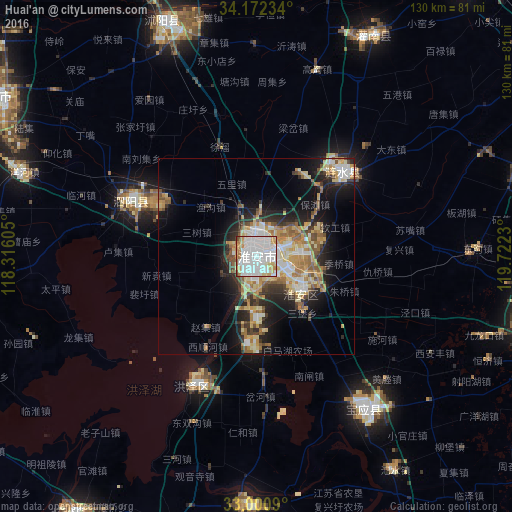
Analysis of Huai'an night lights 2016
Square area 10x10 km:
 51.47%
90-99
28.39%80-89
7.51%70-79
6.41%60-69
4.21%50-59
1.47%40-49
0.55%30-39
0%20-29
0%10-19
0%0-9
0%Square area 50x50 km:
3.88%90-99
3.54%80-89
3.93%70-79
2.94%60-69
3.16%50-59
2.57%40-49
2.14%30-39
2.37%20-29
5.26%10-19
9.83%0-9
60.38%Clear (daylight) street map image can be seen on geolist.org.
Map coordinates:
34° 10' 20.4" North, 118° 18' 57.8" East
33° 35' 19" North, 119° 1' 9" East
33° 0' 3.2" North, 119° 43' 20.3" East
Some cities around Huai'an sort by population:
• Xinghua
104.7 km =65.1 mi,  133°
133°
• Gaoyou
97.2 km =60.4 mi,  156°
156°
• Baoying
48.2 km =30 mi,  146°
146°
• Dongkan
87.8 km =54.6 mi,  58°
58°
• Guiren
77.4 km =48.1 mi,  276°
276°
• Zhongxing
34 km =21.1 mi,  292°
292°
• Gaogou
50.2 km =31.2 mi,  18°
18°
• Qinnan
91 km =56.5 mi,  114°
114°
1797873 (p: 555,230)
Sources (retrieved 2019-11-25):
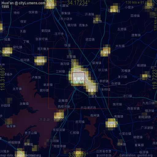
» NASA, Earths city lights 1995
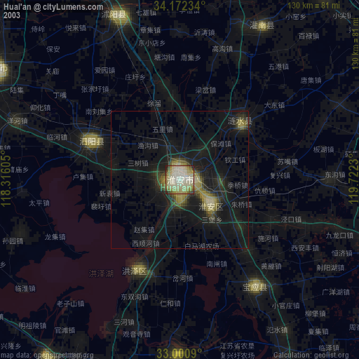
» NASA city lights 2003
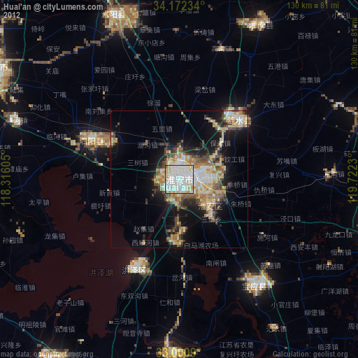
» Earth at Night: Flat Maps 2012, 2016