Dalianwan night lights from space
Night Light of Dalianwan (Liaoning) from space (China) Src. Average luminocity for 10x10km area is 77.6445% and for 50x50km: 32.4901%.
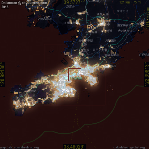
Analysis of Dalianwan night lights 2016
Square area 10x10 km:
 19.48%
90-99
22.08%80-89
11.04%70-79
18.02%60-69
8.6%50-59
6.66%40-49
4.71%30-39
4.38%20-29
5.03%10-19
0%0-9
0%Square area 50x50 km:
8.3%90-99
6.2%80-89
3.56%70-79
4.98%60-69
3.68%50-59
3.7%40-49
3.94%30-39
3.99%20-29
6.9%10-19
10.95%0-9
43.79%Clear (daylight) street map image can be seen on geolist.org.
Map coordinates:
39° 34' 21.8" North, 120° 59' 30.8" East
39° 1' 43" North, 121° 41' 42" East
38° 28' 49" North, 122° 23' 53.3" East
Some cities around Dalianwan sort by population:
• Yantai
174 km =108.1 mi,  187°
187°
• Wafangdian
70.9 km =44.1 mi,  22°
22°
• Jinzhou
8.2 km =5.1 mi,  13°
13°
• Weihai
172.9 km =107.4 mi,  167°
167°
• Pulandian
47 km =29.2 mi,  29°
29°
• Dengzhou
158.3 km =98.4 mi,  210°
210°
• Lüshun
44.9 km =27.9 mi,  235°
235°
• Zhuanghe
134.2 km =83.4 mi,  56°
56°
1921372 (p: 55,841)
Sources (retrieved 2019-11-25):
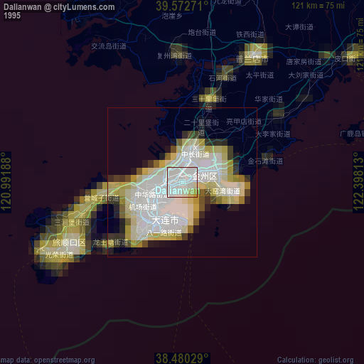
» NASA, Earths city lights 1995
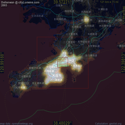
» NASA city lights 2003
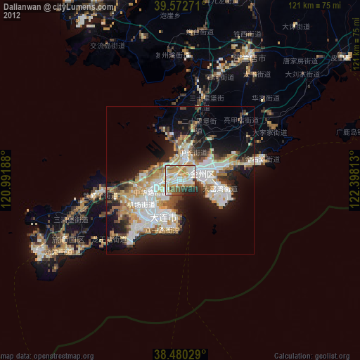
» Earth at Night: Flat Maps 2012, 2016