Zhenzhou night lights from space
Night Light of Zhenzhou (Jiangsu) from space (China) Src. Average luminocity for 10x10km area is 75.2326% and for 50x50km: 32.6004%.
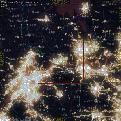
Analysis of Zhenzhou night lights 2016
Square area 10x10 km:
 21.06%
90-99
18.5%80-89
12.27%70-79
8.79%60-69
9.34%50-59
8.06%40-49
13%30-39
7.51%20-29
1.47%10-19
0%0-9
0%Square area 50x50 km:
6.56%90-99
5.86%80-89
3.96%70-79
3.45%60-69
5.31%50-59
4.32%40-49
4.76%30-39
5.08%20-29
9.2%10-19
12.56%0-9
38.95%Clear (daylight) street map image can be seen on geolist.org.
Map coordinates:
32° 52' 22.2" North, 118° 28' 0.7" East
32° 16' 49.2" North, 119° 10' 12" East
31° 41' 2.2" North, 119° 52' 23.2" East
Some cities around Zhenzhou sort by population:
• Nanjing
44.2 km =27.5 mi,  236°
236°
• Zhenjiang
27.9 km =17.3 mi,  106°
106°
• Taizhou
73.1 km =45.4 mi,  71°
71°
• Yangzhou
28.2 km =17.5 mi,  62°
62°
• Gaoyou
62.1 km =38.6 mi,  24°
24°
• Xiannü
40.2 km =25 mi, 65°
• Taixing
80.4 km =50 mi,  99°
99°
• Xiaolingwei
40.6 km =25.2 mi,  227°
227°
1784580 (p: 176,006)
Sources (retrieved 2019-11-25):
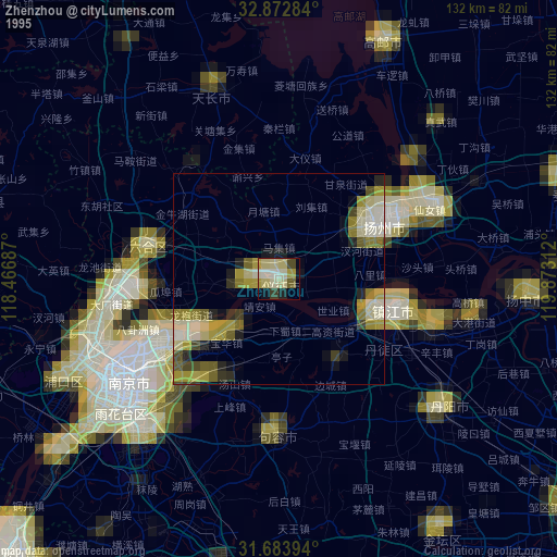
» NASA, Earths city lights 1995
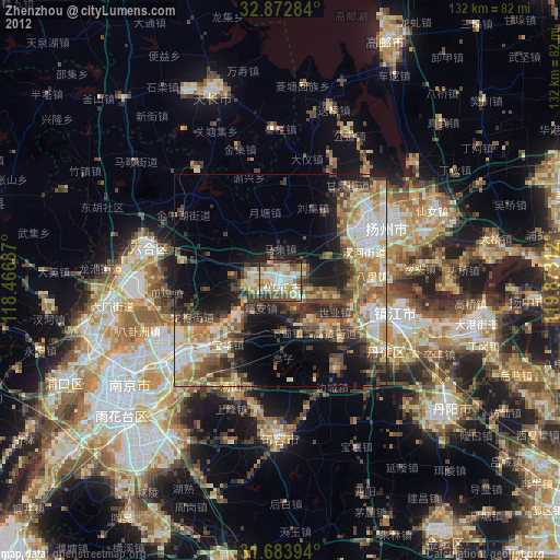
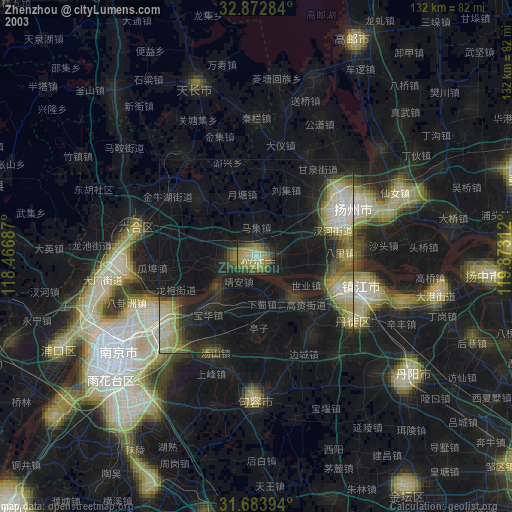
» NASA city lights 2003
» Earth at Night: Flat Maps 2012, 2016