Dschang night lights from space
Night Light of Dschang (West) from space (Cameroon) Src. Average luminocity for 10x10km area is 0.7459% and for 50x50km: 0.0819%.
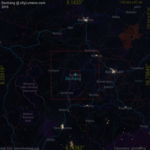
Analysis of Dschang night lights 2016
Square area 10x10 km:
 0%
0%90-99
0%80-89
0%70-79
0.83%60-69
0%50-59
0%40-49
0%30-39
0%20-29
0%10-19
0.83%0-9
98.35%Square area 50x50 km:
0%90-99
0%80-89
0.03%70-79
0.03%60-69
0%50-59
0.03%40-49
0%30-39
0%20-29
0%10-19
0.04%0-9
99.85%Clear (daylight) street map image can be seen on geolist.org.
Map coordinates:
6° 8' 36.6" North, 9° 21' 0.7" East
5° 26' 38.3" North, 10° 3' 12" East
4° 44' 37.1" North, 10° 45' 23.2" East
Some cities around Dschang sort by population:
• Bafoussam
40.5 km =25.2 mi,  84°
84°
• Mbouda
30.1 km =18.7 mi,  47°
47°
• Bafang
34.7 km =21.6 mi,  156°
156°
• Fontem
19.2 km =11.9 mi,  278°
278°
• Melong
37.2 km =23.1 mi,  195°
195°
• Bansoa
28.8 km =17.9 mi,  89°
89°
• Bandjoun
40.6 km =25.2 mi,  100°
100°
• Bamendjou
31.2 km =19.4 mi, 101°
2232444 (p: 96,112)
Sources (retrieved 2019-11-25):
» NASA, Earths city lights 1995
» NASA city lights 2003
» Earth at Night: Flat Maps 2012, 2016