Coronel night lights from space
Night Light of Coronel (Biobío) from space (Chile) Src. Average luminocity for 10x10km area is 38.1922% and for 50x50km: 9.4837%.
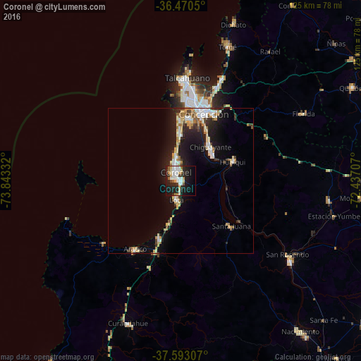
Analysis of Coronel night lights 2016
Square area 10x10 km:
 10.03%
90-99
7.82%80-89
5.27%70-79
3.06%60-69
1.19%50-59
4.25%40-49
1.36%30-39
2.72%20-29
16.84%10-19
29.59%0-9
17.86%Square area 50x50 km:
1.68%90-99
1.51%80-89
1.32%70-79
1.21%60-69
1.12%50-59
0.74%40-49
0.73%30-39
0.93%20-29
2.58%10-19
7.81%0-9
80.39%Clear (daylight) street map image can be seen on geolist.org.
Map coordinates:
36° 28' 13.8" South, 73° 50' 36" West
37° 2' 1.9" South, 73° 8' 24.7" West
37° 35' 35.1" South, 72° 26' 13.5" West
Some cities around Coronel sort by population:
• Talcahuano
34.4 km =21.4 mi,  3°
3°
• Concepción
24.4 km =15.2 mi,  19°
19°
• Chiguayante
15.6 km =9.7 mi,  39°
39°
• Lota
6.4 km =4 mi,  193°
193°
• Tomé
49.1 km =30.5 mi, 19°
• Penco
35 km =21.7 mi, 21°
• Arauco
28.4 km =17.6 mi,  213°
213°
• Laja
47.1 km =29.3 mi,  126°
126°
3893532 (p: 92,940)
Sources (retrieved 2019-11-25):
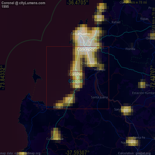
» NASA, Earths city lights 1995
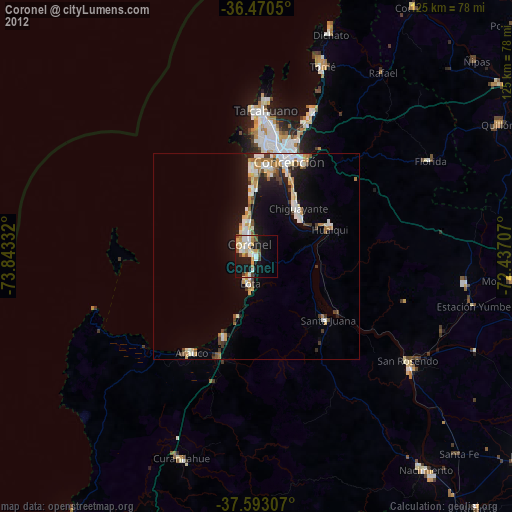
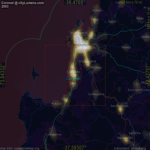
» NASA city lights 2003
» Earth at Night: Flat Maps 2012, 2016