Nueva Imperial night lights from space
Night Light of Nueva Imperial (Araucanía) from space (Chile) Src. Average luminocity for 10x10km area is 4.4847% and for 50x50km: 1.3591%.
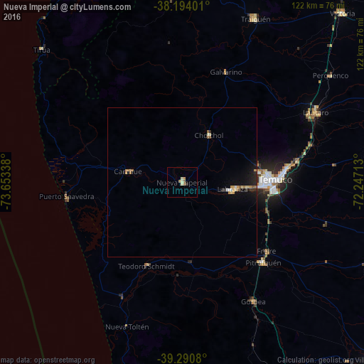
Analysis of Nueva Imperial night lights 2016
Square area 10x10 km:
 0%
0%90-99
1.19%80-89
0.85%70-79
0.68%60-69
1.19%50-59
0.85%40-49
0%30-39
0.68%20-29
0%10-19
0%0-9
94.56%Square area 50x50 km:
0.05%90-99
0.15%80-89
0.19%70-79
0.28%60-69
0.23%50-59
0.16%40-49
0.03%30-39
0.14%20-29
0.33%10-19
1.1%0-9
97.36%Clear (daylight) street map image can be seen on geolist.org.
Map coordinates:
38° 11' 38.4" South, 73° 39' 12.2" West
38° 44' 40.2" South, 72° 57' 0.9" West
39° 17' 26.9" South, 72° 14' 49.7" West
Some cities around Nueva Imperial sort by population:
• Temuco
30.5 km =19 mi,  88°
88°
• Lautaro
50.6 km =31.4 mi,  61°
61°
• Loncoche
74.5 km =46.3 mi,  158°
158°
• Traiguén
60.2 km =37.4 mi,  23°
23°
• Pitrufquén
38.2 km =23.7 mi,  134°
134°
• Carahue
18.7 km =11.6 mi,  281°
281°
• Vilcún
63.4 km =39.4 mi,  82°
82°
• Freire
36.3 km =22.6 mi, 129°
3878456 (p: 18,777)
Sources (retrieved 2019-11-25):
» Earth at Night: Flat Maps 2012, 2016