Machalí night lights from space
Night Light of Machalí (O'Higgins Region) from space (Chile) Src. Average luminocity for 10x10km area is 39.1813% and for 50x50km: 11.383%.
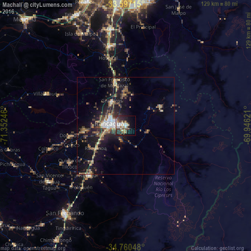

Analysis of Machalí night lights 2016
Square area 10x10 km:
 6.78%
6.78%90-99
7.51%80-89
6.96%70-79
2.01%60-69
3.11%50-59
6.41%40-49
6.96%30-39
5.68%20-29
14.47%10-19
17.77%0-9
22.34%Square area 50x50 km:
1.05%90-99
1.2%80-89
1.7%70-79
1.04%60-69
1.38%50-59
2.14%40-49
1.99%30-39
2.36%20-29
3.39%10-19
10.46%0-9
73.28%Clear (daylight) street map image can be seen on geolist.org.
Map coordinates:
33° 35' 49.7" South, 71° 21' 8.9" West
34° 10' 51" South, 70° 38' 57.6" West
34° 45' 37.7" South, 69° 56' 46.4" West
Some cities around Machalí sort by population:
• Rancagua
8.8 km =5.5 mi,  277°
277°
• Buin
50.6 km =31.4 mi,  350°
350°
• Talagante
62.9 km =39.1 mi,  335°
335°
• Rengo
31.6 km =19.6 mi,  217°
217°
• Paine
42.3 km =26.3 mi, 348°
• San Vicente de Tagua Tagua
48.7 km =30.3 mi,  233°
233°
• Graneros
14.4 km =8.9 mi,  330°
330°
• San Vicente
48.8 km =30.3 mi, 234°
3881102 (p: 27,595)
Sources (retrieved 2019-11-25):
» Earth at Night: Flat Maps 2012, 2016