Los Ángeles night lights from space
Night Light of Los Ángeles (Biobío) from space (Chile) Src. Average luminocity for 10x10km area is 48.6607% and for 50x50km: 3.6031%.
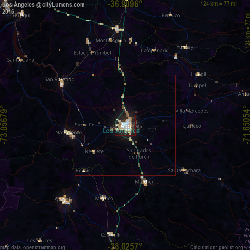
Analysis of Los Ángeles night lights 2016
Square area 10x10 km:
 9.74%
9.74%90-99
10.06%80-89
10.39%70-79
3.9%60-69
5.03%50-59
3.41%40-49
3.25%30-39
6.98%20-29
18.34%10-19
27.11%0-9
1.79%Square area 50x50 km:
0.41%90-99
0.48%80-89
0.62%70-79
0.42%60-69
0.39%50-59
0.36%40-49
0.41%30-39
0.62%20-29
1.07%10-19
2.68%0-9
92.55%Clear (daylight) street map image can be seen on geolist.org.
Map coordinates:
36° 54' 34.6" South, 73° 3' 24.4" West
37° 28' 11" South, 72° 21' 13.2" West
38° 1' 32.5" South, 71° 39' 1.9" West
Some cities around Los Ángeles sort by population:
• Angol
48.3 km =30 mi,  221°
221°
• Mulchén
29.4 km =18.3 mi,  160°
160°
• Nacimiento
28.4 km =17.6 mi,  262°
262°
• Cabrero
48.7 km =30.3 mi,  354°
354°
• Laja
37.7 km =23.4 mi,  303°
303°
• Collipulli
54.4 km =33.8 mi,  187°
187°
• Bulnes
81 km =50.3 mi,  3°
3°
• Yumbel
45.2 km =28.1 mi,  336°
336°
3882428 (p: 125,430)
Sources (retrieved 2019-11-25):
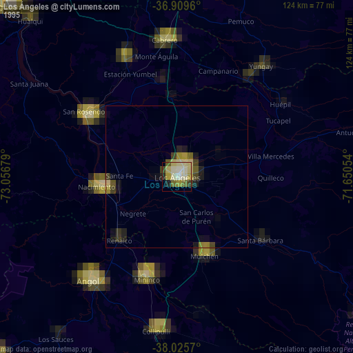
» NASA, Earths city lights 1995
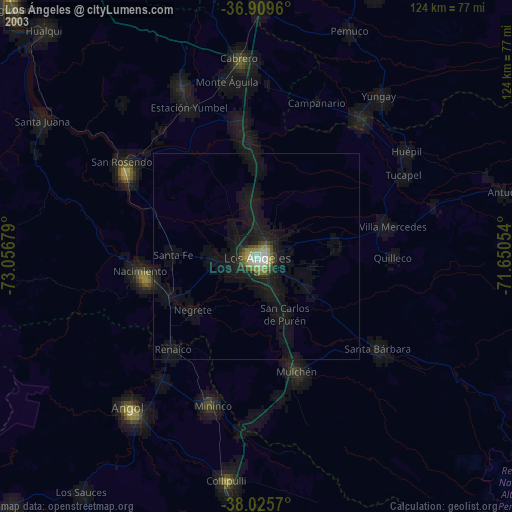
» NASA city lights 2003
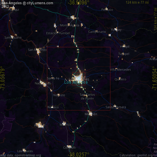
» Earth at Night: Flat Maps 2012, 2016