Dornach night lights from space
Night Light of Dornach (Solothurn) from space (Switzerland) Src. Average luminocity for 10x10km area is 30.919% and for 50x50km: 16.5519%.
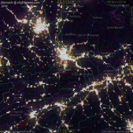
Analysis of Dornach night lights 2016
Square area 10x10 km:
 1.28%
1.28%90-99
4.69%80-89
3.27%70-79
4.69%60-69
3.27%50-59
6.11%40-49
3.69%30-39
11.22%20-29
15.91%10-19
21.31%0-9
24.57%Square area 50x50 km:
2.11%90-99
2.66%80-89
1.21%70-79
1.71%60-69
2.04%50-59
2.55%40-49
2.52%30-39
2.99%20-29
4.76%10-19
12.58%0-9
64.88%Clear (daylight) street map image can be seen on geolist.org.
Map coordinates:
47° 57' 12.3" North, 6° 54' 48" East
47° 28' 49.4" North, 7° 36' 59.2" East
47° 0' 10.9" North, 8° 19' 10.5" East
Some cities around Dornach sort by population:
• Muttenz
5.2 km =3.2 mi,  24°
24°
• Pratteln
7.3 km =4.5 mi,  52°
52°
• Münchenstein
4.3 km =2.7 mi,  353°
353°
• Oberwil
5.8 km =3.6 mi,  310°
310°
• Aesch
1.8 km =1.1 mi,  234°
234°
• Therwil
5 km =3.1 mi,  295°
295°
• Arlesheim
1.5 km =0.9 mi,  9°
9°
• Bottmingen
5.8 km =3.6 mi,  325°
325°
2660989 (p: 6,449)
Sources (retrieved 2019-11-25):
» Earth at Night: Flat Maps 2012, 2016