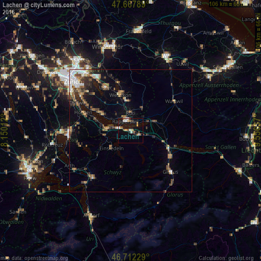
Lachen night lights from space
Night Light of Lachen (Schwyz) from space (Switzerland) Src. Average luminocity for 10x10km area is 17.497% and for 50x50km: 8.2245%.
Analysis of Lachen night lights 2016
Square area 10x10 km:
 2.53%
2.53%90-99
2.23%80-89
1.19%70-79
3.87%60-69
2.08%50-59
1.19%40-49
2.98%30-39
0.89%20-29
1.64%10-19
17.71%0-9
63.69%Square area 50x50 km:
1.14%90-99
1.1%80-89
0.59%70-79
0.86%60-69
1.36%50-59
1.19%40-49
1.61%30-39
1.26%20-29
1.9%10-19
3.97%0-9
85.02%Clear (daylight) street map image can be seen on geolist.org.
Map coordinates:
47° 40' 4.4" North, 8° 9' 0.4" East
47° 11' 32.1" North, 8° 51' 11.7" East
46° 42' 44.2" North, 9° 33' 22.9" East
Some cities around Lachen sort by population:
• Rapperswil
4.4 km =2.7 mi,  327°
327°
• Jona
4.3 km =2.7 mi,  345°
345°
• Freienbach
7.3 km =4.5 mi,  281°
281°
• Rüti
7.1 km =4.4 mi,  1°
1°
• Schübelbach
6 km =3.7 mi,  110°
110°
• Pfäffikon
5.8 km =3.6 mi, 279°
• Siebnen
3.9 km =2.4 mi,  120°
120°
• Altendorf
1.2 km =0.7 mi,  257°
257°
2660075 (p: 6,685)
Sources (retrieved 2019-11-25):
» Earth at Night: Flat Maps 2012, 2016