Cham night lights from space
Night Light of Cham (Zug) from space (Switzerland) Src. Average luminocity for 10x10km area is 22.939% and for 50x50km: 14.5502%.
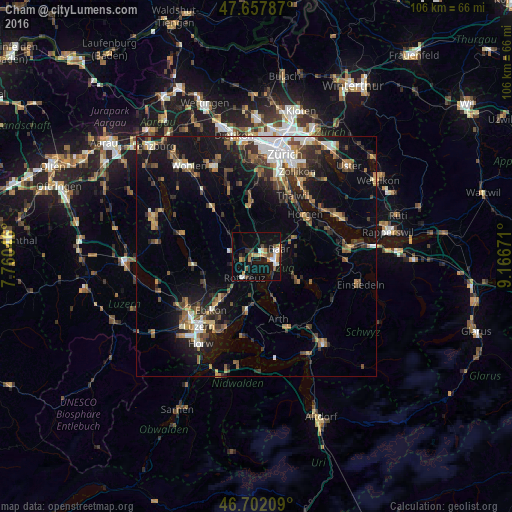
Analysis of Cham night lights 2016
Square area 10x10 km:
 2.08%
2.08%90-99
4.32%80-89
0.89%70-79
5.65%60-69
2.23%50-59
3.27%40-49
2.38%30-39
2.53%20-29
2.98%10-19
24.4%0-9
49.26%Square area 50x50 km:
1.88%90-99
1.91%80-89
1%70-79
1.45%60-69
2.4%50-59
2.03%40-49
2.6%30-39
2.65%20-29
3.56%10-19
11.19%0-9
69.32%Clear (daylight) street map image can be seen on geolist.org.
Map coordinates:
47° 39' 28.3" North, 7° 45' 37.7" East
47° 10' 55.7" North, 8° 27' 48.9" East
46° 42' 7.5" North, 9° 10' 0.2" East
Some cities around Cham sort by population:
• Zug
4.2 km =2.6 mi,  104°
104°
• Baar
5.2 km =3.2 mi,  72°
72°
• Küssnacht
10.9 km =6.8 mi,  188°
188°
• Rotkreuz
5 km =3.1 mi,  209°
209°
• Hünenberg
3 km =1.9 mi,  255°
255°
• Affoltern am Albis
10.6 km =6.6 mi,  354°
354°
• Steinhausen
2.2 km =1.4 mi,  49°
49°
• Unterägeri
10.5 km =6.5 mi,  118°
118°
2661228 (p: 13,495)
Sources (retrieved 2019-11-25):
» Earth at Night: Flat Maps 2012, 2016