Carouge night lights from space
Night Light of Carouge (Geneva) from space (Switzerland) Src. Average luminocity for 10x10km area is 72.1449% and for 50x50km: 17.8493%.
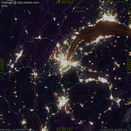
Analysis of Carouge night lights 2016
Square area 10x10 km:
 19.74%
90-99
20.88%80-89
7.81%70-79
5.26%60-69
12.07%50-59
7.95%40-49
12.78%30-39
5.97%20-29
5.11%10-19
2.41%0-9
0%Square area 50x50 km:
2.14%90-99
2.9%80-89
1.34%70-79
1.57%60-69
2.29%50-59
2.7%40-49
3.61%30-39
3.5%20-29
5.06%10-19
16.62%0-9
58.27%Clear (daylight) street map image can be seen on geolist.org.
Map coordinates:
46° 39' 56.3" North, 5° 26' 9.9" East
46° 10' 51.5" North, 6° 8' 21.2" East
45° 41' 31.1" North, 6° 50' 32.4" East
Some cities around Carouge sort by population:
• Genève
2.4 km =1.5 mi,  11°
11°
• Lancy
2.1 km =1.3 mi,  297°
297°
• Onex
2.9 km =1.8 mi,  276°
276°
• Thônex
4.7 km =2.9 mi,  80°
80°
• Plan-les-Ouates
2.3 km =1.4 mi,  230°
230°
• Chêne-Bougeries
4.1 km =2.5 mi,  61°
61°
• Veyrier
3.8 km =2.4 mi,  114°
114°
• Chêne-Bourg
4.5 km =2.8 mi,  69°
69°
2661265 (p: 19,344)
Sources (retrieved 2019-11-25):
» Earth at Night: Flat Maps 2012, 2016