Bussigny night lights from space
Night Light of Bussigny (Vaud) from space (Switzerland) Src. Average luminocity for 10x10km area is 52.5795% and for 50x50km: 11.8854%.
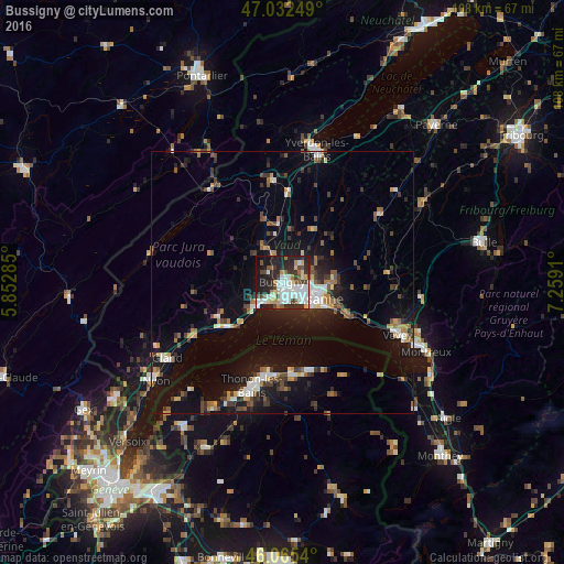
Analysis of Bussigny night lights 2016
Square area 10x10 km:
 13.35%
90-99
15.06%80-89
4.83%70-79
3.27%60-69
3.98%50-59
4.12%40-49
7.39%30-39
7.1%20-29
19.32%10-19
18.61%0-9
2.98%Square area 50x50 km:
1.49%90-99
1.88%80-89
0.9%70-79
1.15%60-69
1.45%50-59
1.44%40-49
1.72%30-39
1.95%20-29
3.15%10-19
10.02%0-9
74.84%Clear (daylight) street map image can be seen on geolist.org.
Map coordinates:
47° 1' 57" North, 5° 51' 10.3" East
46° 33' 4" North, 6° 33' 21.5" East
46° 3' 55.4" North, 7° 15' 32.8" East
Some cities around Bussigny sort by population:
• Renens
2.8 km =1.7 mi,  116°
116°
• Morges
6.2 km =3.9 mi,  224°
224°
• Prilly
4 km =2.5 mi,  112°
112°
• Ecublens
2.5 km =1.6 mi,  168°
168°
• Crissier
1.6 km =1 mi, 111°
• Blécherette
5.2 km =3.2 mi,  104°
104°
• Chavannes
2.6 km =1.6 mi,  154°
154°
• Le Mont-sur-Lausanne
5.8 km =3.6 mi,  82°
82°
2661305 (p: 7,408)
Sources (retrieved 2019-11-25):
» Earth at Night: Flat Maps 2012, 2016