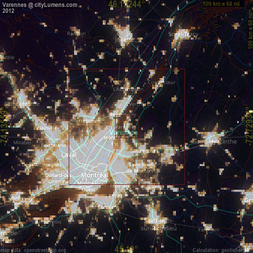
Varennes night lights from space
Night Light of Varennes (Quebec) from space (Canada) Src. Average luminocity for 10x10km area is 51.5167% and for 50x50km: 45.1516%.
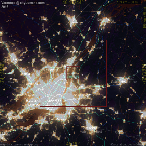
Analysis of Varennes night lights 2016
Square area 10x10 km:
 5.45%
5.45%90-99
10.76%80-89
3.64%70-79
4.24%60-69
9.09%50-59
9.09%40-49
15.45%30-39
23.18%20-29
8.94%10-19
10%0-9
0.15%Square area 50x50 km:
17.83%90-99
9.49%80-89
2.96%70-79
3.82%60-69
4.42%50-59
4.92%40-49
4.34%30-39
4.56%20-29
6.05%10-19
9.3%0-9
32.32%Clear (daylight) street map image can be seen on geolist.org.
Map coordinates:
46° 10' 20.8" North, 74° 8' 8.1" West
45° 41' 0.2" North, 73° 25' 56.9" West
45° 11' 24" North, 72° 43' 45.6" West
Some cities around Varennes sort by population:
• Repentigny
6.7 km =4.2 mi,  348°
348°
• Saint-Léonard
16.5 km =10.3 mi,  229°
229°
• Boucherville
10.3 km =6.4 mi,  181°
181°
• Mascouche
14.9 km =9.3 mi,  299°
299°
• Sainte-Julie
13.6 km =8.5 mi,  145°
145°
• L'Assomption
15.5 km =9.6 mi,  0°
0°
• Saint-Amable
11 km =6.8 mi,  109°
109°
• Charlemagne
5.4 km =3.4 mi,  313°
313°
6173508 (p: 20,950)
Sources (retrieved 2019-11-25):
» Earth at Night: Flat Maps 2012, 2016