Boucherville night lights from space
Night Light of Boucherville (Quebec) from space (Canada) Src. Average luminocity for 10x10km area is 79.3818% and for 50x50km: 52.9127%.
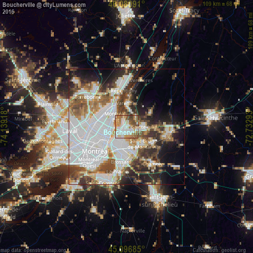
Analysis of Boucherville night lights 2016
Square area 10x10 km:
 22.88%
90-99
23.18%80-89
5%70-79
13.18%60-69
14.7%50-59
11.67%40-49
7.88%30-39
1.52%20-29
0%10-19
0%0-9
0%Square area 50x50 km:
20.22%90-99
11.4%80-89
3.65%70-79
4.55%60-69
5.13%50-59
5.74%40-49
6.53%30-39
5.97%20-29
7.98%10-19
8.71%0-9
20.12%Clear (daylight) street map image can be seen on geolist.org.
Map coordinates:
46° 4' 51.3" North, 74° 8' 21" West
45° 35' 27.7" North, 73° 26' 9.8" West
45° 5' 48.7" North, 72° 43' 58.5" West
Some cities around Boucherville sort by population:
• Longueuil
9.2 km =5.7 mi,  223°
223°
• Saint-Léonard
12.4 km =7.7 mi,  268°
268°
• Sainte-Julie
8.1 km =5 mi,  96°
96°
• Saint-Bruno-de-Montarville
9.3 km =5.8 mi,  133°
133°
• Varennes
10.3 km =6.4 mi,  1°
1°
• Saint-Basile-le-Grand
13.6 km =8.5 mi,  118°
118°
• Saint-Amable
12.5 km =7.8 mi,  58°
58°
• Charlemagne
14.4 km =8.9 mi,  345°
345°
5906267 (p: 39,062)
Sources (retrieved 2019-11-25):
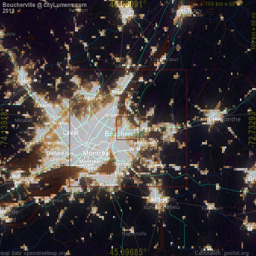
» Earth at Night: Flat Maps 2012, 2016