Mascouche night lights from space
Night Light of Mascouche (Quebec) from space (Canada) Src. Average luminocity for 10x10km area is 50.9773% and for 50x50km: 43.2196%.
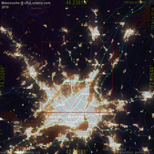
Analysis of Mascouche night lights 2016
Square area 10x10 km:
 10.15%
90-99
11.21%80-89
6.52%70-79
6.06%60-69
5.45%50-59
9.09%40-49
6.36%30-39
5.91%20-29
14.55%10-19
21.21%0-9
3.48%Square area 50x50 km:
14.71%90-99
9.4%80-89
3.73%70-79
4.5%60-69
4.79%50-59
4.8%40-49
4.33%30-39
4.41%20-29
5.63%10-19
8.78%0-9
34.9%Clear (daylight) street map image can be seen on geolist.org.
Map coordinates:
46° 14' 17.3" North, 74° 18' 9.7" West
45° 44' 58.7" North, 73° 35' 58.4" West
45° 15' 24.7" North, 72° 53' 47.2" West
Some cities around Mascouche sort by population:
• Terrebonne
6.6 km =4.1 mi,  213°
213°
• Repentigny
11.6 km =7.2 mi,  94°
94°
• Varennes
14.9 km =9.3 mi,  119°
119°
• L'Assomption
15.5 km =9.6 mi,  58°
58°
• Sainte-Anne-des-Plaines
16.5 km =10.3 mi,  275°
275°
• Lorraine
16 km =9.9 mi,  242°
242°
• Bois-des-Filion
14.8 km =9.2 mi,  231°
231°
• Charlemagne
9.8 km =6.1 mi,  111°
111°
6067494 (p: 34,626)
Sources (retrieved 2019-11-25):
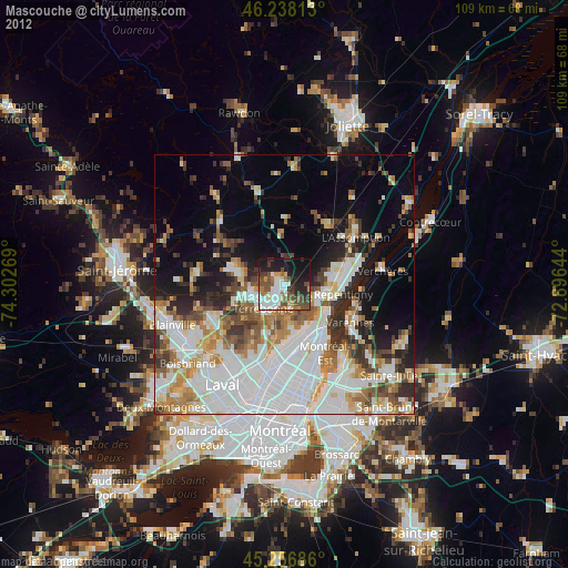
» Earth at Night: Flat Maps 2012, 2016