Sainte Catherine de la Jacques Cartier night lights from space
Night Light of Sainte Catherine de la Jacques Cartier (Quebec) from space (Canada) Src. Average luminocity for 10x10km area is 5.7381% and for 50x50km: 12.1104%.
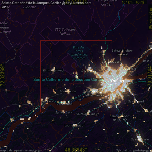
Analysis of Sainte Catherine de la Jacques Cartier night lights 2016
Square area 10x10 km:
 0%
0%90-99
0.74%80-89
1.64%70-79
0%60-69
1.19%50-59
0%40-49
0.89%30-39
2.08%20-29
2.98%10-19
0.6%0-9
89.88%Square area 50x50 km:
2.15%90-99
2.78%80-89
1.23%70-79
1.06%60-69
1.25%50-59
1.71%40-49
1.87%30-39
1.95%20-29
2.71%10-19
4.85%0-9
78.44%Clear (daylight) street map image can be seen on geolist.org.
Map coordinates:
47° 19' 52.1" North, 72° 19' 25.3" West
46° 51' 8.8" North, 71° 37' 14" West
46° 22' 9.9" North, 70° 55' 2.8" West
Some cities around Sainte Catherine de la Jacques Cartier sort by population:
• Québec
31.2 km =19.4 mi,  98°
98°
• Lévis
34.1 km =21.2 mi, 99°
• La Haute-Saint-Charles
19.3 km =12 mi,  77°
77°
• L'Ancienne-Lorette
21.5 km =13.4 mi,  107°
107°
• Laurentides
59.1 km =36.7 mi,  301°
301°
• Pont-Rouge
12.3 km =7.6 mi,  207°
207°
• Donnacona
20.7 km =12.9 mi,  202°
202°
• Shannon
8.6 km =5.3 mi,  68°
68°
6639619 (p: 5,021)
Sources (retrieved 2019-11-25):
» Earth at Night: Flat Maps 2012, 2016