La Haute-Saint-Charles night lights from space
Night Light of La Haute-Saint-Charles (Quebec) from space (Canada) Src. Average luminocity for 10x10km area is 58.2902% and for 50x50km: 22.143%.
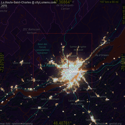
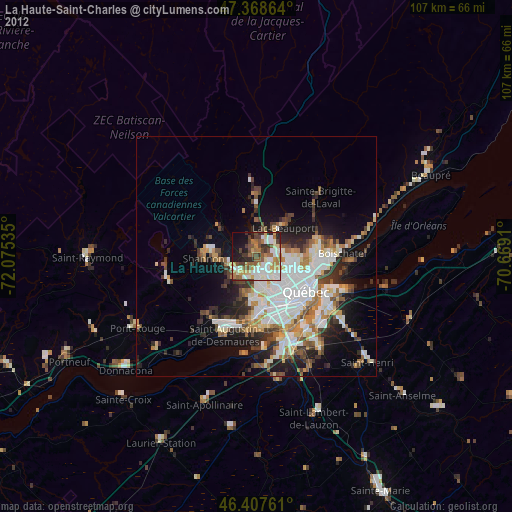
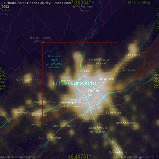
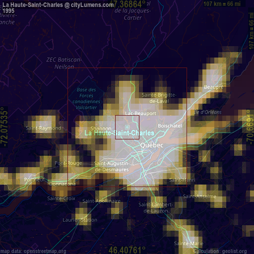
Analysis of La Haute-Saint-Charles night lights 2016
Square area 10x10 km:
 10.42%
90-99
15.48%80-89
7.59%70-79
6.99%60-69
9.38%50-59
7.89%40-49
9.23%30-39
6.85%20-29
11.01%10-19
12.05%0-9
3.13%Square area 50x50 km:
5.32%90-99
5.42%80-89
2.02%70-79
2.25%60-69
2.33%50-59
2.19%40-49
2.94%30-39
3.16%20-29
4.89%10-19
7.84%0-9
61.63%Clear (daylight) street map image can be seen on geolist.org.
Map coordinates:
47° 22' 7.1" North, 72° 4' 31.3" West
46° 53' 25" North, 71° 22' 20" West
46° 24' 27.4" North, 70° 40' 8.8" West
Some cities around La Haute-Saint-Charles sort by population:
• Québec
14.8 km =9.2 mi,  125°
125°
• Lévis
17.7 km =11 mi,  123°
123°
• Saint-Augustin-de-Desmaures
17.7 km =11 mi,  199°
199°
• L'Ancienne-Lorette
10.8 km =6.7 mi,  171°
171°
• Pont-Rouge
28.9 km =18 mi,  238°
238°
• Shannon
10.9 km =6.8 mi,  264°
264°
• Saint-Henri
31.8 km =19.8 mi, 133°
• Sainte Catherine de la Jacques Cartier
19.3 km =12 mi, 257°
11838435 (p: 74,070)
Sources (retrieved 2019-11-25):
» NASA, Earths city lights 1995
» NASA city lights 2003
» Earth at Night: Flat Maps 2012, 2016