Saint-Jean-sur-Richelieu night lights from space
Night Light of Saint-Jean-sur-Richelieu (Quebec) from space (Canada) Src. Average luminocity for 10x10km area is 59.019% and for 50x50km: 20.7276%.
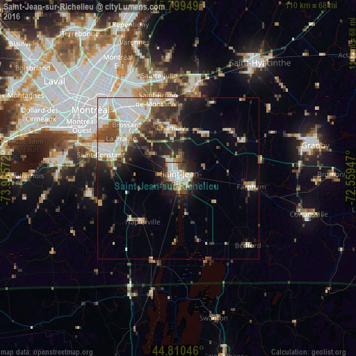

Analysis of Saint-Jean-sur-Richelieu night lights 2016
Square area 10x10 km:
 15.08%
90-99
17.78%80-89
4.29%70-79
4.76%60-69
6.03%50-59
3.81%40-49
11.11%30-39
8.1%20-29
15.56%10-19
12.86%0-9
0.63%Square area 50x50 km:
5.07%90-99
4.81%80-89
1.67%70-79
1.86%60-69
1.62%50-59
2.01%40-49
3.67%30-39
2.99%20-29
5.44%10-19
6.57%0-9
64.29%Clear (daylight) street map image can be seen on geolist.org.
Map coordinates:
45° 47' 58.2" North, 73° 57' 56.6" West
45° 18' 25.7" North, 73° 15' 45.3" West
44° 48' 37.7" North, 72° 33' 34.1" West
Some cities around Saint-Jean-sur-Richelieu sort by population:
• Brossard
22.5 km =14 mi,  315°
315°
• Chambly
16 km =9.9 mi,  354°
354°
• La Prairie
22.1 km =13.7 mi,  303°
303°
• Candiac
21.5 km =13.4 mi,  293°
293°
• Carignan
16.1 km =10 mi, 349°
• Farnham
22.1 km =13.7 mi,  96°
96°
• Marieville
15.9 km =9.9 mi,  28°
28°
• Richelieu
15.2 km =9.4 mi,  4°
4°
6138495 (p: 71,613)
Sources (retrieved 2019-11-25):
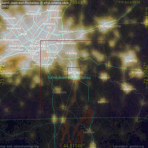
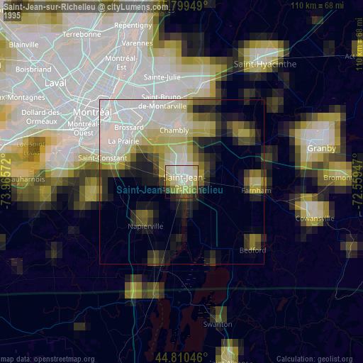
» NASA, Earths city lights 1995
» NASA city lights 2003
» Earth at Night: Flat Maps 2012, 2016