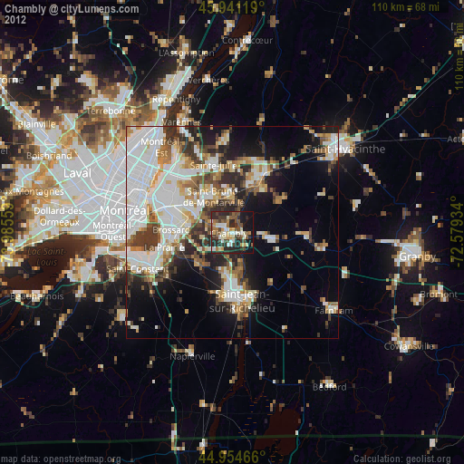
Chambly night lights from space
Night Light of Chambly (Quebec) from space (Canada) Src. Average luminocity for 10x10km area is 45.7286% and for 50x50km: 36.2245%.
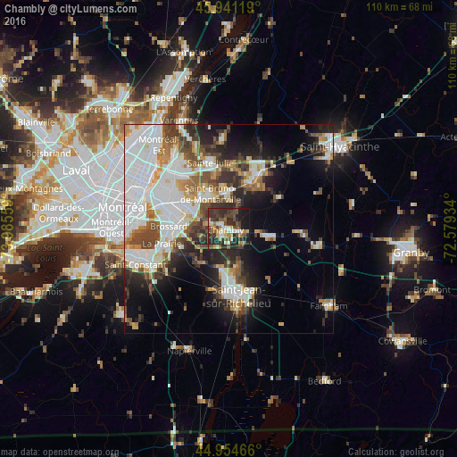
Analysis of Chambly night lights 2016
Square area 10x10 km:
 4.13%
4.13%90-99
6.98%80-89
6.35%70-79
5.4%60-69
4.6%50-59
6.83%40-49
13.65%30-39
13.49%20-29
24.44%10-19
14.13%0-9
0%Square area 50x50 km:
11.1%90-99
8.24%80-89
2.56%70-79
3.5%60-69
3.41%50-59
3.63%40-49
5.11%30-39
4.49%20-29
7.55%10-19
9.85%0-9
40.55%Clear (daylight) street map image can be seen on geolist.org.
Map coordinates:
45° 56' 28.3" North, 73° 59' 8.1" West
45° 27' 0.3" North, 73° 16' 56.9" West
44° 57' 16.8" North, 72° 34' 45.6" West
Some cities around Chambly sort by population:
• Brossard
14.3 km =8.9 mi,  270°
270°
• Saint-Bruno-de-Montarville
10.6 km =6.6 mi,  330°
330°
• Beloeil
14.5 km =9 mi,  24°
24°
• Saint-Basile-le-Grand
9.3 km =5.8 mi,  0°
0°
• Otterburn Park
10.6 km =6.6 mi,  29°
29°
• Carignan
1.3 km =0.8 mi, 270°
• Marieville
9.3 km =5.8 mi,  101°
101°
• Richelieu
2.9 km =1.8 mi, 104°
5919566 (p: 22,608)
Sources (retrieved 2019-11-25):
» Earth at Night: Flat Maps 2012, 2016