Brossard night lights from space
Night Light of Brossard (Quebec) from space (Canada) Src. Average luminocity for 10x10km area is 81.2841% and for 50x50km: 52.239%.
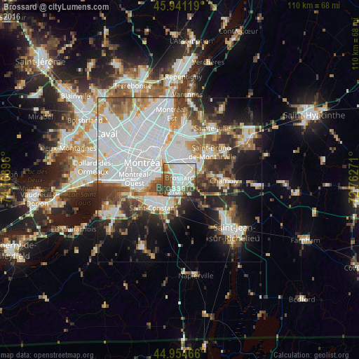
Analysis of Brossard night lights 2016
Square area 10x10 km:
 29.84%
90-99
28.73%80-89
6.83%70-79
4.13%60-69
4.44%50-59
7.3%40-49
15.87%30-39
1.75%20-29
1.11%10-19
0%0-9
0%Square area 50x50 km:
20.53%90-99
11.43%80-89
3.29%70-79
4.52%60-69
4.7%50-59
4.65%40-49
6.19%30-39
5.58%20-29
8.29%10-19
10.51%0-9
20.3%Clear (daylight) street map image can be seen on geolist.org.
Map coordinates:
45° 56' 28.3" North, 74° 10' 8.3" West
45° 27' 0.3" North, 73° 27' 57" West
44° 57' 16.8" North, 72° 45' 45.8" West
Some cities around Brossard sort by population:
• Montréal
11.5 km =7.1 mi,  304°
304°
• Longueuil
9.9 km =6.2 mi,  335°
335°
• Notre-Dame-de-Grâce
12 km =7.5 mi,  284°
284°
• La Prairie
4.5 km =2.8 mi,  215°
215°
• Westmount
11 km =6.8 mi,  289°
289°
• Sainte-Catherine
10.7 km =6.6 mi,  238°
238°
• Candiac
8.4 km =5.2 mi,  207°
207°
• Delson
11.3 km =7 mi, 215°
5909629 (p: 69,575)
Sources (retrieved 2019-11-25):
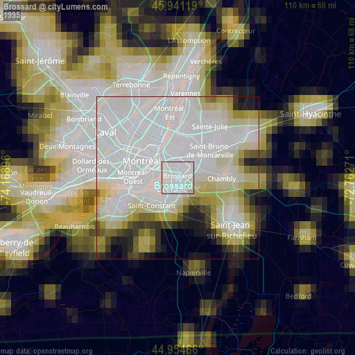
» NASA, Earths city lights 1995
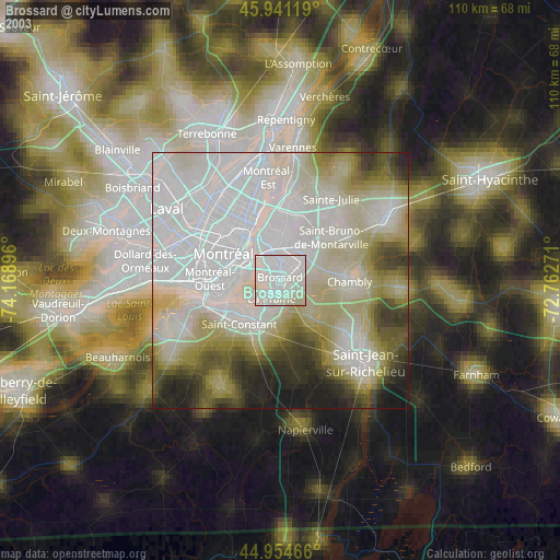
» NASA city lights 2003
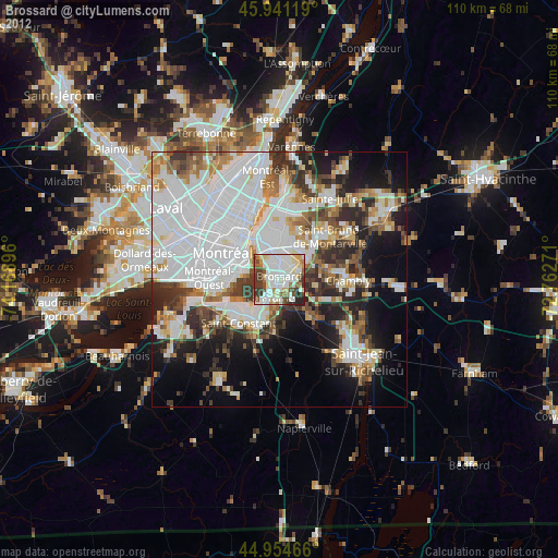
» Earth at Night: Flat Maps 2012, 2016