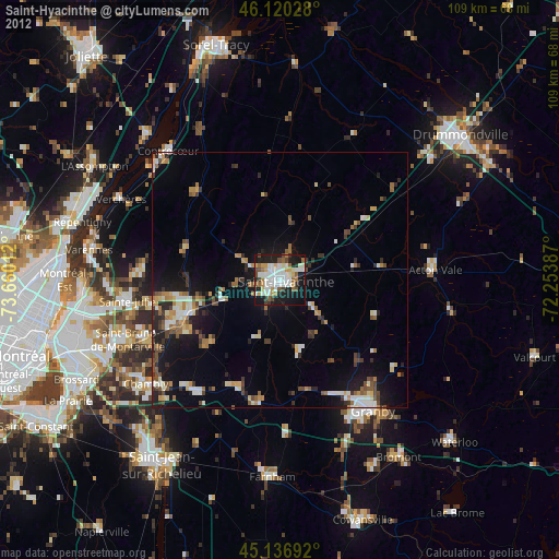
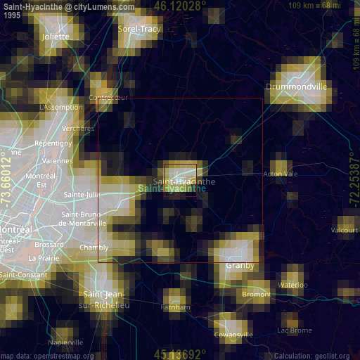
Saint-Hyacinthe night lights from space
Night Light of Saint-Hyacinthe (Quebec) from space (Canada) Src. Average luminocity for 10x10km area is 48.4879% and for 50x50km: 10.121%.
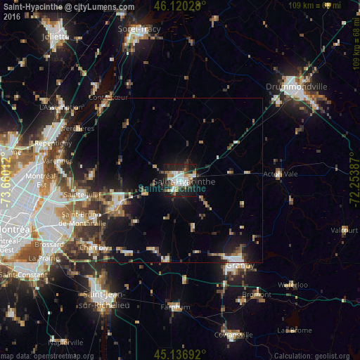

Analysis of Saint-Hyacinthe night lights 2016
Square area 10x10 km:
 13.03%
90-99
12.42%80-89
2.12%70-79
4.7%60-69
4.55%50-59
4.39%40-49
3.03%30-39
6.82%20-29
19.55%10-19
28.03%0-9
1.36%Square area 50x50 km:
1.12%90-99
1.59%80-89
0.75%70-79
1.09%60-69
1.41%50-59
1.32%40-49
1.62%30-39
1.81%20-29
3.61%10-19
7.43%0-9
78.24%Clear (daylight) street map image can be seen on geolist.org.
Map coordinates:
46° 7' 13" North, 73° 39' 36.4" West
45° 37' 50.7" North, 72° 57' 25.2" West
45° 8' 12.9" North, 72° 15' 13.9" West
Some cities around Saint-Hyacinthe sort by population:
• Granby
31 km =19.3 mi,  145°
145°
• Chambly
32.3 km =20.1 mi,  231°
231°
• Beloeil
20.6 km =12.8 mi,  250°
250°
• Mont-Saint-Hilaire
19.3 km =12 mi, 247°
• Otterburn Park
22.9 km =14.2 mi,  241°
241°
• Marieville
27.3 km =17 mi,  216°
216°
• Richelieu
30.7 km =19.1 mi, 227°
• Acton Vale
30.5 km =19 mi,  85°
85°
6138374 (p: 50,326)
Sources (retrieved 2019-11-25):
» NASA, Earths city lights 1995
» NASA city lights 2003
» Earth at Night: Flat Maps 2012, 2016