Granby night lights from space
Night Light of Granby (Quebec) from space (Canada) Src. Average luminocity for 10x10km area is 49.7651% and for 50x50km: 7.5789%.
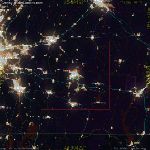
Analysis of Granby night lights 2016
Square area 10x10 km:
 12.86%
90-99
11.27%80-89
3.65%70-79
3.17%60-69
4.76%50-59
6.51%40-49
7.78%30-39
7.78%20-29
19.37%10-19
22.22%0-9
0.63%Square area 50x50 km:
0.84%90-99
1.11%80-89
0.65%70-79
0.66%60-69
0.97%50-59
1.05%40-49
1.26%30-39
1.32%20-29
2.09%10-19
5.39%0-9
84.65%Clear (daylight) street map image can be seen on geolist.org.
Map coordinates:
45° 53' 29.8" North, 73° 26' 8" West
45° 24' 0.3" North, 72° 43' 56.7" West
44° 54' 15.2" North, 72° 1' 45.5" West
Some cities around Granby sort by population:
• Saint-Hyacinthe
31 km =19.3 mi,  325°
325°
• Mont-Saint-Hilaire
39.9 km =24.8 mi,  297°
297°
• Cowansville
22.3 km =13.9 mi,  183°
183°
• Farnham
23.5 km =14.6 mi,  236°
236°
• Lac-Brome
26.5 km =16.5 mi,  140°
140°
• Marieville
34 km =21.1 mi,  276°
276°
• Saint-Pie
17.9 km =11.1 mi,  309°
309°
• Acton Vale
30.7 km =19.1 mi,  25°
25°
5964215 (p: 53,979)
Sources (retrieved 2019-11-25):
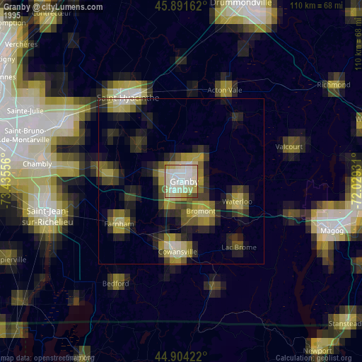
» NASA, Earths city lights 1995
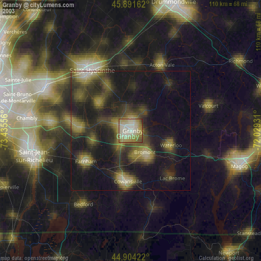
» NASA city lights 2003
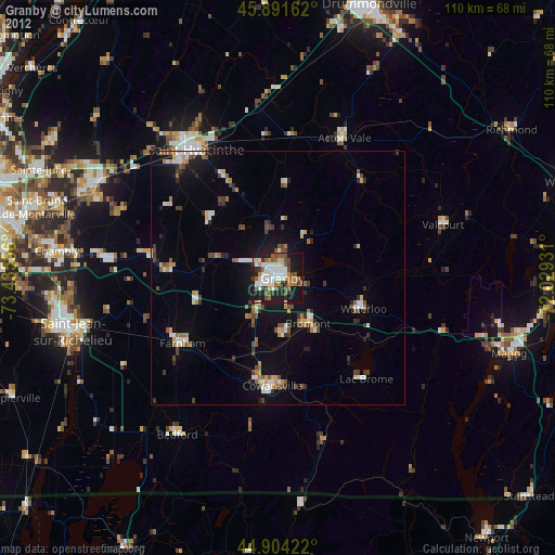
» Earth at Night: Flat Maps 2012, 2016