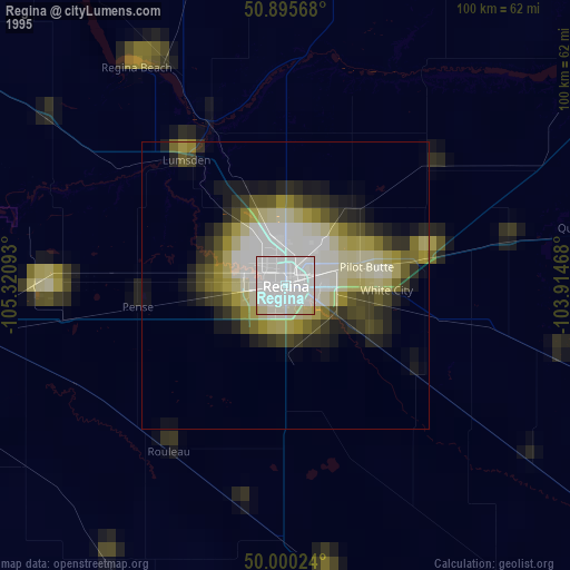
Regina night lights from space
Night Light of Regina (Saskatchewan) from space (Canada) Src. Average luminocity for 10x10km area is 86.3796% and for 50x50km: 7.1817%.
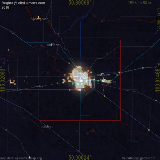
Analysis of Regina night lights 2016
Square area 10x10 km:
 38.94%
90-99
32.21%80-89
7%70-79
2.8%60-69
3.5%50-59
2.66%40-49
2.66%30-39
5.6%20-29
4.2%10-19
0.42%0-9
0%Square area 50x50 km:
1.92%90-99
1.68%80-89
0.67%70-79
0.55%60-69
0.47%50-59
0.73%40-49
0.56%30-39
0.83%20-29
2.08%10-19
3.56%0-9
86.95%Clear (daylight) street map image can be seen on geolist.org.
Map coordinates:
50° 53' 44.4" North, 105° 19' 15.3" West
50° 27' 0.3" North, 104° 37' 4.1" West
50° 0' 0.9" North, 103° 54' 52.8" West
Some cities around Regina sort by population:
• Saskatoon
235.2 km =146.1 mi,  322°
322°
• Moose Jaw
65.2 km =40.5 mi,  265°
265°
• Williston, US
266.1 km =165.3 mi,  164°
164°
• Yorkton
173.4 km =107.7 mi,  60°
60°
• Swift Current
226.5 km =140.7 mi, 265°
• Warman
247.8 km =154 mi,  326°
326°
• Estevan
187.6 km =116.6 mi,  141°
141°
• Weyburn
102.9 km =63.9 mi,  147°
147°
6119109 (p: 176,183)
Sources (retrieved 2019-11-25):
» NASA, Earths city lights 1995
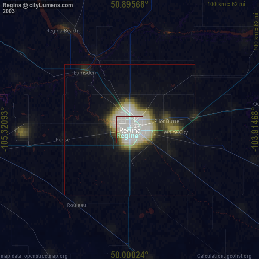
» NASA city lights 2003
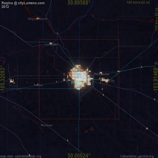
» Earth at Night: Flat Maps 2012, 2016