Maple Ridge night lights from space
Night Light of Maple Ridge (British Columbia) from space (Canada) Src. Average luminocity for 10x10km area is 45.393% and for 50x50km: 26.7656%.
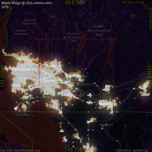

Analysis of Maple Ridge night lights 2016
Square area 10x10 km:
 7.22%
7.22%90-99
9.22%80-89
5.35%70-79
8.02%60-69
3.07%50-59
4.95%40-49
5.88%30-39
9.49%20-29
18.72%10-19
23.26%0-9
4.81%Square area 50x50 km:
7.9%90-99
6.93%80-89
2.39%70-79
2.25%60-69
1.87%50-59
1.96%40-49
2.6%30-39
4.23%20-29
6.38%10-19
9.19%0-9
54.29%Clear (daylight) street map image can be seen on geolist.org.
Map coordinates:
49° 40' 35.4" North, 123° 18' 18.2" West
49° 13' 9.8" North, 122° 36' 6.9" West
48° 45' 28.8" North, 121° 53' 55.7" West
Some cities around Maple Ridge sort by population:
• Surrey
20.5 km =12.7 mi,  232°
232°
• Coquitlam
15 km =9.3 mi,  298°
298°
• Port Coquitlam
13.2 km =8.2 mi,  293°
293°
• Port Moody
17.6 km =10.9 mi, 293°
• Walnut Grove
6.7 km =4.2 mi,  204°
204°
• Langley
13.8 km =8.6 mi, 197°
• Pitt Meadows
6.4 km =4 mi,  271°
271°
• Aldergrove
20.3 km =12.6 mi,  152°
152°
6065686 (p: 70,000)
Sources (retrieved 2019-11-25):
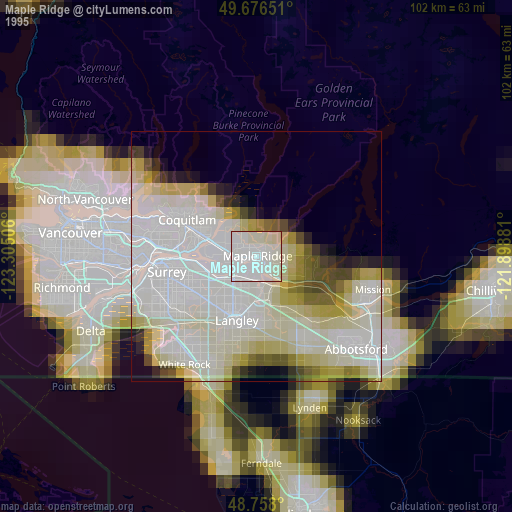
» NASA, Earths city lights 1995
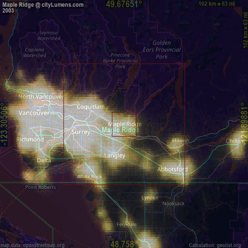
» NASA city lights 2003
» Earth at Night: Flat Maps 2012, 2016